Approximate Location Map
Large Map »
Latitude: 51.5259 / 51°31'33"N
Longitude: -0.0742 / 0°4'27"W
OS Eastings: 533692
OS Northings: 182534
OS Grid: TQ336825
Mapcode National: GBR W7.G5
Mapcode Global: VHGQT.NXM3
Plus Code: 9C3XGWGG+98
Entry Name: Iron Railings at Rochelle Street Primary School
Listing Date: 27 September 1973
Grade: II
Source: Historic England
Source ID: 1065289
English Heritage Legacy ID: 205722
ID on this website: 101065289
Location: Shoreditch, Tower Hamlets, London, E2
County: London
District: Tower Hamlets
Electoral Ward/Division: Weavers
Parish: Non Civil Parish
Built-Up Area: Tower Hamlets
Traditional County: Middlesex
Lieutenancy Area (Ceremonial County): Greater London
Church of England Parish: St Leonard with S Michael, Shoreditch
Church of England Diocese: London
Tagged with: Guard rail
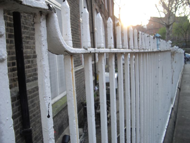
TQ 3382 ARNOLD CIRCUS E2
BOUNDARY ESTATE
8/65 Iron railings at Rochelle Street
Primary School
GV II
Iron railings with urn finials.
Listing NGR: TQ3369382534
External links are from the relevant listing authority and, where applicable, Wikidata. Wikidata IDs may be related buildings as well as this specific building. If you want to add or update a link, you will need to do so by editing the Wikidata entry.


Other nearby listed buildings
