Approximate Location Map
Large Map »
Latitude: 51.5185 / 51°31'6"N
Longitude: -0.046 / 0°2'45"W
OS Eastings: 535674
OS Northings: 181766
OS Grid: TQ356817
Mapcode National: GBR J9.52C
Mapcode Global: VHGR1.5317
Plus Code: 9C3XGX93+CJ
Entry Name: Drinking Fountain
Listing Date: 27 September 1973
Grade: II
Source: Historic England
Source ID: 1065062
English Heritage Legacy ID: 206254
ID on this website: 101065062
Location: Stepney, Tower Hamlets, London, E1
County: London
District: Tower Hamlets
Electoral Ward/Division: Stepney Green
Parish: Non Civil Parish
Built-Up Area: Tower Hamlets
Traditional County: Middlesex
Lieutenancy Area (Ceremonial County): Greater London
Church of England Parish: St Dunstan Stepney
Church of England Diocese: London
Tagged with: Drinking fountain
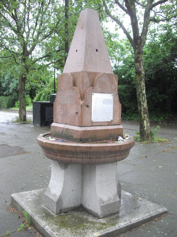
STEPNEY GREEN E1
1.
4431
(South West Side)
Drinking Fountain
TQ 3581 16/573
II
2.
Erected 1884. Red and grey granite drinking fountain. Large red bowl with trefoil
headed plaques from which rises a small truncated spire.
Listing NGR: TQ3567481766
External links are from the relevant listing authority and, where applicable, Wikidata. Wikidata IDs may be related buildings as well as this specific building. If you want to add or update a link, you will need to do so by editing the Wikidata entry.


Other nearby listed buildings
