Approximate Location Map
Large Map »
Latitude: 51.3644 / 51°21'51"N
Longitude: -0.1635 / 0°9'48"W
OS Eastings: 527949
OS Northings: 164415
OS Grid: TQ279644
Mapcode National: GBR DD.ZBL
Mapcode Global: VHGRK.3YXY
Plus Code: 9C3X9R7P+QJ
Entry Name: East and west churchyard walls
Listing Date: 1 March 1974
Grade: II
Source: Historic England
Source ID: 1183508
English Heritage Legacy ID: 206729
ID on this website: 101183508
Location: Carshalton, Sutton, London, SM5
County: London
District: Sutton
Electoral Ward/Division: Carshalton Central
Parish: Non Civil Parish
Built-Up Area: Sutton
Traditional County: Surrey
Lieutenancy Area (Ceremonial County): Greater London
Church of England Parish: Carshalton All Saints
Church of England Diocese: Southwark
Tagged with: Architectural structure
TQ 2764 SE 20/79
TQ 2864 SW 23/79
CARSHALTON
HIGH STREET (South Side)
East and west churchyard walls
GV
II
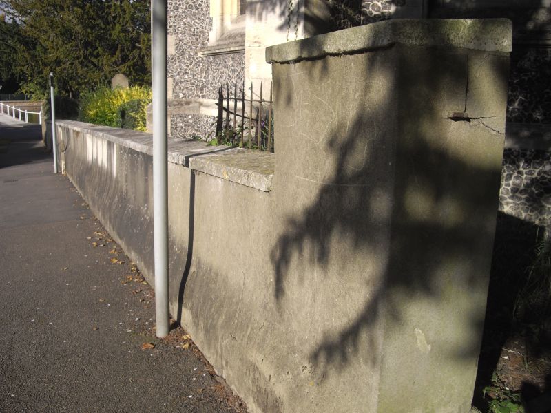
East churchyard wall to south of No 4 is a high structure of brick with capping, probably of C19 date; this extends south from No 4 High Street as far as corner behind No 13 The Square; from this point it turns west; brick pilasters and two brick piers with capping. At western corner a brick pier with the following inscription: "To the glory of God and in loving memory of Palliser Barrow all the land south and west of this spot was given to extend the churchyard by Samuel Barrow JP of The Grove, Carshalton, April 1915".
North-west wall of churchyard which also forms boundary with Madeley Cottage and St Mary's comprises part of former boundary wall to Carshalton Park; C18; red brick with some patching; this continues south and west to rear of Nos 20 and 21 Church Hill and to north as far as west entrance to churchyard by Madeley Cottage; entry by Madeley Cottage flanked by wide low stuccoed piers. To north of this, low stuccoed wall with plinth and capping extends as far as north Churchyard Walk.
From the south the Church forms a group with No 4 High Street, with churchyard walls and with wall to south of No 6 High Street [See other group note for Church].
Listing NGR: TQ2794964415
External links are from the relevant listing authority and, where applicable, Wikidata. Wikidata IDs may be related buildings as well as this specific building. If you want to add or update a link, you will need to do so by editing the Wikidata entry.


Other nearby listed buildings
