Approximate Location Map
Large Map »
Latitude: 51.4527 / 51°27'9"N
Longitude: -0.1517 / 0°9'6"W
OS Eastings: 528524
OS Northings: 174260
OS Grid: TQ285742
Mapcode National: GBR F2.8F8
Mapcode Global: VHGR5.BR56
Plus Code: 9C3XFR3X+38
Entry Name: Bollards East and West Sides of Street Near Junction with Nightingale Lane
Listing Date: 7 April 1983
Grade: II
Source: Historic England
Source ID: 1065577
English Heritage Legacy ID: 206970
ID on this website: 101065577
Location: Clapham Common, Wandsworth, London, SW12
County: London
District: Wandsworth
Electoral Ward/Division: Balham
Parish: Non Civil Parish
Built-Up Area: Wandsworth
Traditional County: Surrey
Lieutenancy Area (Ceremonial County): Greater London
Church of England Parish: Balham Hill The Ascension
Church of England Diocese: Southwark
Tagged with: Building
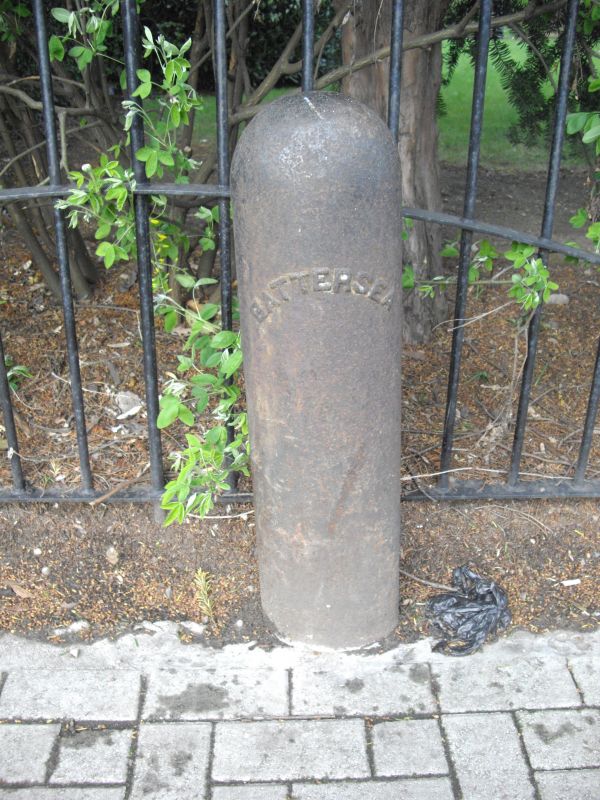
ALDERBROOK ROAD SW12
1.
5033
Bollards on east and
west sides of street
near junction with
Nightingale Lane
TQ 2874 13/17
II
2.
Probably 1870's. Cast iron. Oval on plan. Legend: 'Battersea'.
Listing NGR: TQ2852474260
External links are from the relevant listing authority and, where applicable, Wikidata. Wikidata IDs may be related buildings as well as this specific building. If you want to add or update a link, you will need to do so by editing the Wikidata entry.


Other nearby listed buildings
