Approximate Location Map
Large Map »
Latitude: 51.4498 / 51°26'59"N
Longitude: -0.2396 / 0°14'22"W
OS Eastings: 522424
OS Northings: 173786
OS Grid: TQ224737
Mapcode National: GBR 9Q.J7Q
Mapcode Global: VHGR3.STPF
Plus Code: 9C3XCQX6+W5
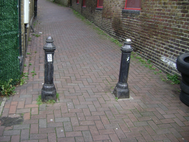
Entry Name: Two Bollards at Junction with Medfield Street
Listing Date: 7 April 1983
Grade: II
Source: Historic England
Source ID: 1065556
English Heritage Legacy ID: 206994
ID on this website: 101065556
Location: Roehampton, Wandsworth, London, SW15
County: London
District: Wandsworth
Electoral Ward/Division: Roehampton
Parish: Non Civil Parish
Built-Up Area: Wandsworth
Traditional County: Surrey
Lieutenancy Area (Ceremonial County): Greater London
Church of England Parish: Roehampton Holy Trinity
Church of England Diocese: Southwark
Tagged with: Bollard
BLACKFORD'S PATH SW15
1.
5033
Two bollards at junction
with Medfield Street
TQ 2273 11/6
II
2 .
19th Century, cast iron, octagonal shafts.
Listing NGR: TQ2242473786
External links are from the relevant listing authority and, where applicable, Wikidata. Wikidata IDs may be related buildings as well as this specific building. If you want to add or update a link, you will need to do so by editing the Wikidata entry.


Other nearby listed buildings
