Approximate Location Map
Large Map »
Latitude: 51.45 / 51°26'59"N
Longitude: -0.2401 / 0°14'24"W
OS Eastings: 522390
OS Northings: 173798
OS Grid: TQ223737
Mapcode National: GBR 9Q.J4D
Mapcode Global: VHGR3.STFB
Plus Code: 9C3XCQX5+XX
Entry Name: The Montague Arms Public House
Listing Date: 7 April 1983
Grade: II
Source: Historic England
Source ID: 1184425
English Heritage Legacy ID: 207073
Also known as: Montague Arms, Roehampton
ID on this website: 101184425
Location: Roehampton, Wandsworth, London, SW15
County: London
District: Wandsworth
Electoral Ward/Division: Roehampton
Parish: Non Civil Parish
Built-Up Area: Wandsworth
Traditional County: Surrey
Lieutenancy Area (Ceremonial County): Greater London
Church of England Parish: Roehampton Holy Trinity
Church of England Diocese: Southwark
Tagged with: Pub
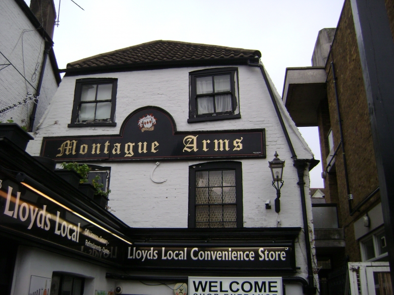
MEDFIELD STREET SW15
1.
5033
No 3
(The Montague Arms
public house)
TQ 2273 11/2
II
2.
17th Century, altered. Three storeys. Two windows. Painted brick. Tile and
concrete pantile mansard. Flush framed windows. Brick nogged passage wall.
Listing NGR: TQ2239073798
External links are from the relevant listing authority and, where applicable, Wikidata. Wikidata IDs may be related buildings as well as this specific building. If you want to add or update a link, you will need to do so by editing the Wikidata entry.


Other nearby listed buildings
