Approximate Location Map
Large Map »
Latitude: 51.5329 / 51°31'58"N
Longitude: -0.1797 / 0°10'46"W
OS Eastings: 526357
OS Northings: 183126
OS Grid: TQ263831
Mapcode National: GBR 34.VN
Mapcode Global: VHGQR.TQWR
Plus Code: 9C3XGRMC+54
Entry Name: Forecourt Wall and Gatepiers to Numbers 28 and 30
Listing Date: 9 January 1970
Grade: II
Source: Historic England
Source ID: 1066534
English Heritage Legacy ID: 208468
ID on this website: 101066534
Location: St John's Wood, Westminster, London, NW8
County: London
District: City of Westminster
Electoral Ward/Division: Abbey Road
Parish: Non Civil Parish
Built-Up Area: City of Westminster
Traditional County: Middlesex
Lieutenancy Area (Ceremonial County): Greater London
Church of England Parish: St Mark Hamilton Terrace
Church of England Diocese: London
Tagged with: Wall
TQ 2683 SW CITY OF WESTMINSTER ABERCORN PLACE, NW8
11/73 (south side)
9.1.70
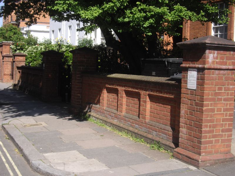
Forecourt wall and
gate piers to Nos 28
and 30
GV II
Forecourt wall. Red brick. Panelled. Included for group value only.
Listing NGR: TQ2635783126
External links are from the relevant listing authority and, where applicable, Wikidata. Wikidata IDs may be related buildings as well as this specific building. If you want to add or update a link, you will need to do so by editing the Wikidata entry.


Other nearby listed buildings
