Approximate Location Map
Large Map »
Latitude: 51.5096 / 51°30'34"N
Longitude: -0.1244 / 0°7'27"W
OS Eastings: 530260
OS Northings: 180633
OS Grid: TQ302806
Mapcode National: GBR JF.70
Mapcode Global: VHGQZ.SBM2
Plus Code: 9C3XGV5G+R7
Entry Name: K2 Telephone Kiosk
Listing Date: 9 September 1986
Grade: II
Source: Historic England
Source ID: 1292477
English Heritage Legacy ID: 208498
ID on this website: 101292477
Location: London, Westminster, London, WC2N
County: London
District: City of Westminster
Electoral Ward/Division: St James's
Parish: Non Civil Parish
Built-Up Area: City of Westminster
Traditional County: Middlesex
Lieutenancy Area (Ceremonial County): Greater London
Church of England Parish: St Martin-in-the-Fields
Church of England Diocese: London
Tagged with: K2 telephone box
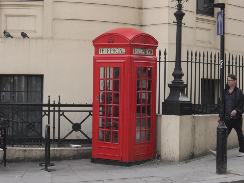
TQ 3080 NW CITY OF WESTMINSTER AGAR STREET, WC2
K2 telephone kiosk
9.9.86
GV II
Telephone kiosk 1927. By Giles Gilbert Scott. Cast iron. Intact square kiosk
of K2 type with domed roof, perforated crowns to top panels and glazing bars
to windows and door.
Listing NGR: TQ3026080632
External links are from the relevant listing authority and, where applicable, Wikidata. Wikidata IDs may be related buildings as well as this specific building. If you want to add or update a link, you will need to do so by editing the Wikidata entry.


Other nearby listed buildings
