Approximate Location Map
Large Map »
Latitude: 51.498 / 51°29'52"N
Longitude: -0.155 / 0°9'17"W
OS Eastings: 528167
OS Northings: 179282
OS Grid: TQ281792
Mapcode National: GBR 9K.C6
Mapcode Global: VHGQZ.8MF0
Plus Code: 9C3XFRXW+52
Entry Name: Mews Arch to Southern End of Belgrave Mews West
Listing Date: 1 December 1987
Grade: II
Source: Historic England
Source ID: 1066451
English Heritage Legacy ID: 208635
ID on this website: 101066451
Location: Belgravia, Westminster, London, SW1X
County: London
District: City of Westminster
Electoral Ward/Division: Knightsbridge and Belgravia
Parish: Non Civil Parish
Built-Up Area: City of Westminster
Traditional County: Middlesex
Lieutenancy Area (Ceremonial County): Greater London
Church of England Parish: St Paul Knightsbridge
Church of England Diocese: London
Tagged with: Building
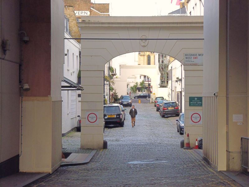
TQ 2879 SW CITY OF WESTMINSTER BELGRAVE MEWS WEST, SW1
97/59
Mews arch to Southern end of
Belgrave Mews West.
II GV
Mews arch. Early mid C19. Stucco. Segmented, rusticated.
Listing NGR: TQ2816779282
External links are from the relevant listing authority and, where applicable, Wikidata. Wikidata IDs may be related buildings as well as this specific building. If you want to add or update a link, you will need to do so by editing the Wikidata entry.


Other nearby listed buildings
