Approximate Location Map
Large Map »
Latitude: 51.5004 / 51°30'1"N
Longitude: -0.1533 / 0°9'11"W
OS Eastings: 528276
OS Northings: 179558
OS Grid: TQ282795
Mapcode National: GBR 9J.R9
Mapcode Global: VHGQZ.9K94
Plus Code: 9C3XGR2W+5M
Entry Name: Railings and Gate Piers to Number 49
Listing Date: 9 January 1970
Grade: II*
Source: Historic England
Source ID: 1066461
English Heritage Legacy ID: 208657
ID on this website: 101066461
Location: Hyde Park Corner, Westminster, London, SW1X
County: London
District: City of Westminster
Electoral Ward/Division: Knightsbridge and Belgravia
Parish: Non Civil Parish
Built-Up Area: City of Westminster
Traditional County: Middlesex
Lieutenancy Area (Ceremonial County): Greater London
Church of England Parish: St Paul Knightsbridge
Church of England Diocese: London
TQ 2879 NW CITY OF WESTMINSTER BELGRAVE SQUARE SW1
88/42
9.1.70 Railings and gate
piers to No 49
GV
II*
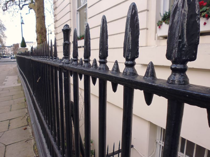
Railings and gate piers. Mid C19. Cast iron railings. Stucco piers. Spear
head design.
Listing NGR: TQ2827679558
External links are from the relevant listing authority and, where applicable, Wikidata. Wikidata IDs may be related buildings as well as this specific building. If you want to add or update a link, you will need to do so by editing the Wikidata entry.


Other nearby listed buildings
