Approximate Location Map
Large Map »
Latitude: 51.5232 / 51°31'23"N
Longitude: -0.1648 / 0°9'53"W
OS Eastings: 527413
OS Northings: 182075
OS Grid: TQ274820
Mapcode National: GBR 78.EN
Mapcode Global: VHGQS.3Z65
Plus Code: 9C3XGRFP+73
Entry Name: Boundary Wall to St Edward's Convent
Listing Date: 2 August 1983
Grade: II
Source: Historic England
Source ID: 1066695
English Heritage Legacy ID: 210069
ID on this website: 101066695
Location: Lisson Grove, Westminster, London, NW1
County: London
District: City of Westminster
Electoral Ward/Division: Bryanston and Dorset Square
Parish: Non Civil Parish
Built-Up Area: City of Westminster
Traditional County: Middlesex
Lieutenancy Area (Ceremonial County): Greater London
Church of England Parish: St Paul, St Marylebone
Church of England Diocese: London
Tagged with: Wall
TQ 2782 SW CITY OF WESTMINSTER HAREWOOD AVENUE, NW1
33/8
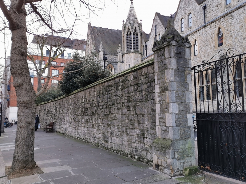
Boundary Wall to St Edward's
2.8.83 Convent
G.V. II
Boundary wall. c.1844. Ragstone with weathered plinth and coping, gabled
buttress piers and pointed arch doorway.
Listing NGR: TQ2741382075
External links are from the relevant listing authority and, where applicable, Wikidata. Wikidata IDs may be related buildings as well as this specific building. If you want to add or update a link, you will need to do so by editing the Wikidata entry.


Other nearby listed buildings
