Approximate Location Map
Large Map »
Latitude: 51.5075 / 51°30'26"N
Longitude: -0.1495 / 0°8'58"W
OS Eastings: 528525
OS Northings: 180352
OS Grid: TQ285803
Mapcode National: GBR BF.MS
Mapcode Global: VHGQZ.CCBP
Plus Code: 9C3XGV42+X6
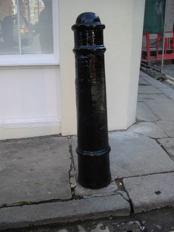
Entry Name: Bollard, on Corner with Waverton Street, Outside Number 28
Listing Date: 1 December 1987
Grade: II
Source: Historic England
Source ID: 1230732
English Heritage Legacy ID: 210138
ID on this website: 101230732
Location: Mayfair, Westminster, London, W1J
County: London
District: City of Westminster
Electoral Ward/Division: West End
Parish: Non Civil Parish
Built-Up Area: City of Westminster
Traditional County: Middlesex
Lieutenancy Area (Ceremonial County): Greater London
Church of England Parish: St George, Hanover Square
Church of England Diocese: London
Tagged with: Bollard
TQ 2880 SE CITY OF WESTMINSTER HAY'S MEWS, W1
80/95 Bollard, on corner with
Waverton Street, outside
- No 28
GV II
Bollard. Early C19. Cast iron of the cannon type.
Listing NGR: TQ2852580352
External links are from the relevant listing authority and, where applicable, Wikidata. Wikidata IDs may be related buildings as well as this specific building. If you want to add or update a link, you will need to do so by editing the Wikidata entry.


Other nearby listed buildings
