Approximate Location Map
Large Map »
Latitude: 53.5298 / 53°31'47"N
Longitude: -2.2862 / 2°17'10"W
OS Eastings: 381127
OS Northings: 403721
OS Grid: SD811037
Mapcode National: GBR DWGM.VD
Mapcode Global: WH983.VJJV
Plus Code: 9C5VGPH7+WG
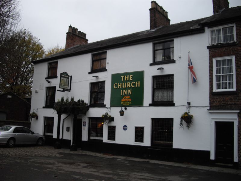
Entry Name: Church Inn
Listing Date: 30 June 1966
Grade: II
Source: Historic England
Source ID: 1067251
English Heritage Legacy ID: 210619
Also known as: The Church Inn, Manchester
ID on this website: 101067251
Location: Prestwich, Bury, Greater Manchester, M25
County: Bury
Electoral Ward/Division: St Mary's
Parish: Non Civil Parish
Built-Up Area: Manchester
Traditional County: Lancashire
Lieutenancy Area (Ceremonial County): Greater Manchester
Church of England Parish: Prestwich St Mary
Church of England Diocese: Manchester
SD 80 SW CHURCH LANE
10/114
30.6.66 Church Inn
GV II
C18, altered. Brown brick; front rendered, with Ashlar scoring. 3 very wide windows
with sashes of Victorian type. Interior has roll-edged beams and fielded 6-panel
doors. Abuts no 38.
Listing NGR: SD8112703721
External links are from the relevant listing authority and, where applicable, Wikidata. Wikidata IDs may be related buildings as well as this specific building. If you want to add or update a link, you will need to do so by editing the Wikidata entry.


Other nearby listed buildings
