Approximate Location Map
Large Map »
Latitude: 53.5292 / 53°31'45"N
Longitude: -2.2867 / 2°17'11"W
OS Eastings: 381094
OS Northings: 403653
OS Grid: SD810036
Mapcode National: GBR DWGM.RL
Mapcode Global: WH983.VK99
Plus Code: 9C5VGPH7+M8
Entry Name: Sundial to South of Church of St Mary
Listing Date: 29 January 1985
Grade: II
Source: Historic England
Source ID: 1067255
English Heritage Legacy ID: 210626
ID on this website: 101067255
Location: St Mary's Church, Prestwich, Bury, Greater Manchester, M25
County: Bury
Electoral Ward/Division: St Mary's
Parish: Non Civil Parish
Built-Up Area: Manchester
Traditional County: Lancashire
Lieutenancy Area (Ceremonial County): Greater Manchester
Church of England Parish: Prestwich St Mary
Church of England Diocese: Manchester
Tagged with: Sundial
SD 80 SW CHURCH LANE
10/121
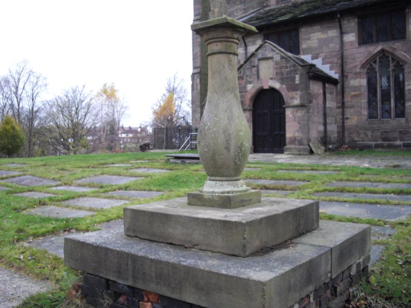
Sundial to south of
- Church of St Mary
GV II
Probably C18. Large baluster on 2 steps. Metalwork lost, including railings
on upper step.
Listing NGR: SD8109403653
External links are from the relevant listing authority and, where applicable, Wikidata. Wikidata IDs may be related buildings as well as this specific building. If you want to add or update a link, you will need to do so by editing the Wikidata entry.


Other nearby listed buildings
