Approximate Location Map
Large Map »
Latitude: 53.6351 / 53°38'6"N
Longitude: -2.3343 / 2°20'3"W
OS Eastings: 377989
OS Northings: 415454
OS Grid: SD779154
Mapcode National: GBR DV4D.FM
Mapcode Global: WH97J.3WPL
Plus Code: 9C5VJMP8+37
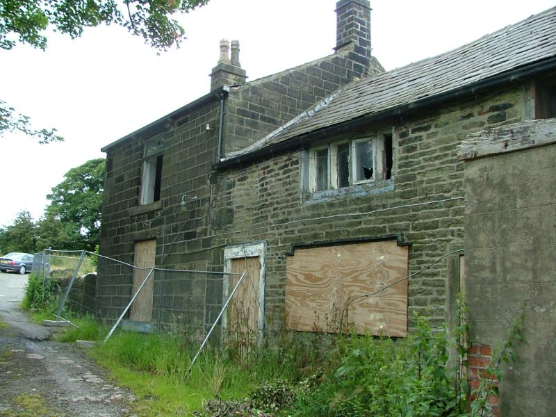
Entry Name: Lumb Carr Farmhouse
Listing Date: 29 January 1985
Grade: II
Source: Historic England
Source ID: 1318230
English Heritage Legacy ID: 210669
ID on this website: 101318230
Location: Hazelhurst, Bury, Greater Manchester, BL8
County: Bury
Electoral Ward/Division: Ramsbottom
Parish: Non Civil Parish
Built-Up Area: Ramsbottom
Traditional County: Lancashire
Lieutenancy Area (Ceremonial County): Greater Manchester
Church of England Parish: Holcombe and Hawkshaw
Church of England Diocese: Manchester
Tagged with: Farmhouse
SD 71 NE
3/144
LUMB CARR ROAD
Lumb Carr Farmhouse
II
Probably C18. Rubble. 2 storeys. 2 4-light stone splay-mullioned windows, that
on the right on ground floor being 3-light, door to left. Another door for
left.
Listing NGR: SD7798915454
External links are from the relevant listing authority and, where applicable, Wikidata. Wikidata IDs may be related buildings as well as this specific building. If you want to add or update a link, you will need to do so by editing the Wikidata entry.


Other nearby listed buildings
