Approximate Location Map
Large Map »
Latitude: 53.5909 / 53°35'27"N
Longitude: -2.2996 / 2°17'58"W
OS Eastings: 380264
OS Northings: 410526
OS Grid: SD802105
Mapcode National: GBR DVCX.YG
Mapcode Global: WH97X.N04F
Plus Code: 9C5VHPR2+95
Entry Name: 3, Manchester Road
Listing Date: 29 January 1985
Grade: II
Source: Historic England
Source ID: 1356843
English Heritage Legacy ID: 210672
ID on this website: 101356843
Location: Bury, Greater Manchester, BL9
County: Bury
Electoral Ward/Division: East
Parish: Non Civil Parish
Built-Up Area: Bury
Traditional County: Lancashire
Lieutenancy Area (Ceremonial County): Greater Manchester
Church of England Parish: Bury St Mary the Virgin
Church of England Diocese: Manchester
Tagged with: Building
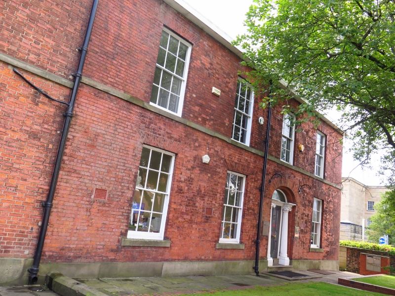
SD 8010 NW MANCHESTER ROAD
1/40 (east side)
- No 3
GV II
Circa 1830, altered at rear C1850. Red brick. 2 storeys. 4 sash windows with
glazing bars. Beneath the 3rd window is door of 6 moulded panels flanked by Ionic
columns with depressed arch; engraved glass fan. Sill band. Probably later box
gutter cornice. Rich plasterwork in hall. _
Listing NGR: SD8026410526
External links are from the relevant listing authority and, where applicable, Wikidata. Wikidata IDs may be related buildings as well as this specific building. If you want to add or update a link, you will need to do so by editing the Wikidata entry.


Other nearby listed buildings
