Approximate Location Map
Large Map »
Latitude: 53.379 / 53°22'44"N
Longitude: -2.3999 / 2°23'59"W
OS Eastings: 373497
OS Northings: 386979
OS Grid: SJ734869
Mapcode National: GBR CYPC.7F
Mapcode Global: WH98V.3BHF
Plus Code: 9C5V9JH2+H3
Entry Name: Langham Grove Obelisk
Listing Date: 12 July 1985
Grade: II
Source: Historic England
Source ID: 1121904
English Heritage Legacy ID: 212845
ID on this website: 101121904
Location: Little Bollington, Trafford, Greater Manchester, WA14
County: Trafford
Civil Parish: Dunham Massey
Traditional County: Cheshire
Lieutenancy Area (Ceremonial County): Greater Manchester
Church of England Parish: Bowdon St Mary the Virgin
Church of England Diocese: Chester
SJ 78 NW
6/86
DUNHAM MASSEY
DUNHAM PARK
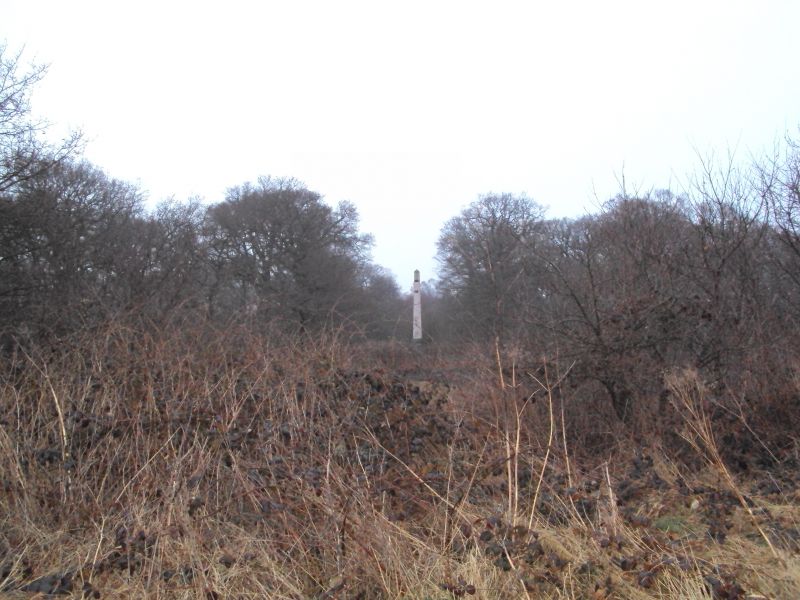
Langham Grove Obelisk
G.V.
II
Obelisk. 1714. Erected by 2nd Earl of Warrington in memory
of his mother. 5-step base. Needle rises from an engraved
pedestal reading "The Langham Grove Planted A.D. 1714 M.H.T."
with moulded base and cornice. There is a tradition that the
obelisk marks the grave of a race-horse.
Listing NGR: SJ7349786979
External links are from the relevant listing authority and, where applicable, Wikidata. Wikidata IDs may be related buildings as well as this specific building. If you want to add or update a link, you will need to do so by editing the Wikidata entry.


Other nearby listed buildings
