Approximate Location Map
Large Map »
Latitude: 53.433 / 53°25'58"N
Longitude: -2.9655 / 2°57'55"W
OS Eastings: 335953
OS Northings: 393348
OS Grid: SJ359933
Mapcode National: GBR 78C.JB
Mapcode Global: WH871.FZ32
Plus Code: 9C5VC2MM+6R
Entry Name: Roseneath Cottage
Listing Date: 14 March 1975
Grade: II
Source: Historic England
Source ID: 1356296
English Heritage Legacy ID: 213693
ID on this website: 101356296
Location: Anfield, Liverpool, Merseyside, L4
County: Liverpool
Electoral Ward/Division: Anfield
Parish: Non Civil Parish
Built-Up Area: Liverpool
Traditional County: Lancashire
Lieutenancy Area (Ceremonial County): Merseyside
Church of England Parish: Walton Breck Christ Church and Holy Trinity
Church of England Diocese: Liverpool
Tagged with: Cottage
SJ 3593
16/91
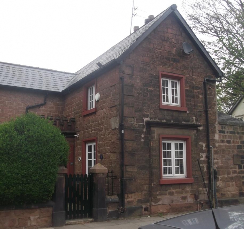
ANFIELD ROAD, L4
No. 5 (Roseneath Cottage)
14.3.75
G.V. II
House. Early C19. Red sandstone coursed rubble with slate
roof, quoins to one angle. 2 storeys. Windows have chamfered
reveals and small-paned casements. Porch in angle with
castellated parapet and architraved entrance.
Listing NGR: SJ3595393348
External links are from the relevant listing authority and, where applicable, Wikidata. Wikidata IDs may be related buildings as well as this specific building. If you want to add or update a link, you will need to do so by editing the Wikidata entry.


Other nearby listed buildings
