Approximate Location Map
Large Map »
Latitude: 53.4285 / 53°25'42"N
Longitude: -2.8076 / 2°48'27"W
OS Eastings: 346433
OS Northings: 392718
OS Grid: SJ464927
Mapcode National: GBR 8XTS.YP
Mapcode Global: WH879.V26Y
Plus Code: 9C5VC5HR+CW
Entry Name: 14, Vicarage Place
Listing Date: 19 March 1987
Grade: II
Source: Historic England
Source ID: 1075507
English Heritage Legacy ID: 215300
ID on this website: 101075507
Location: Prescot, Knowsley, Merseyside, L34
County: Knowsley
Civil Parish: Prescot
Built-Up Area: Prescot
Traditional County: Lancashire
Lieutenancy Area (Ceremonial County): Merseyside
Church of England Parish: Prescot St Mary
Church of England Diocese: Liverpool
Tagged with: Building
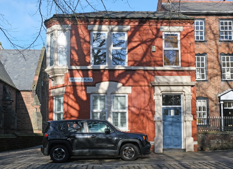
PRESCOT VICARAGE PLACE
SJ 49 SE
(east side)
6/42 No. 14
-
G.V. II
House. Late C18. Brick with stone dressings, slate roof.
2 storeys, one x 2 bays. Gable end to street. Windows have
wedge lintels and are sashed with glazing bars. Entrance
has segmental head. Left return has lateral stack. Built
as servants' quarters to No. 10 (q.v.), which it adjoins.
Listing NGR: SJ4643492717
External links are from the relevant listing authority and, where applicable, Wikidata. Wikidata IDs may be related buildings as well as this specific building. If you want to add or update a link, you will need to do so by editing the Wikidata entry.


Other nearby listed buildings
