Approximate Location Map
Large Map »
Latitude: 53.3342 / 53°20'3"N
Longitude: -2.9777 / 2°58'39"W
OS Eastings: 334990
OS Northings: 382367
OS Grid: SJ349823
Mapcode National: GBR 7YNW.4H
Mapcode Global: WH87M.7G98
Plus Code: 9C5V82MC+MW
Entry Name: Mile Stone to South of Junction with Mark Rake
Listing Date: 2 December 1986
Grade: II
Source: Historic England
Source ID: 1075488
English Heritage Legacy ID: 215349
ID on this website: 101075488
Location: Bromborough, Wirral, Merseyside, CH62
County: Wirral
Electoral Ward/Division: Bromborough
Parish: Non Civil Parish
Built-Up Area: Bebington
Traditional County: Cheshire
Lieutenancy Area (Ceremonial County): Merseyside
Church of England Parish: Bromborough St Barnabas
Church of England Diocese: Chester
Tagged with: Milestone
BEBINGTON BROMBOROUGH VILLAGE ROAD
SJ 38 SW
(west side)
Bromborough
6/39 Mile stone to
south of junction
with Mark Rake
G.V. II
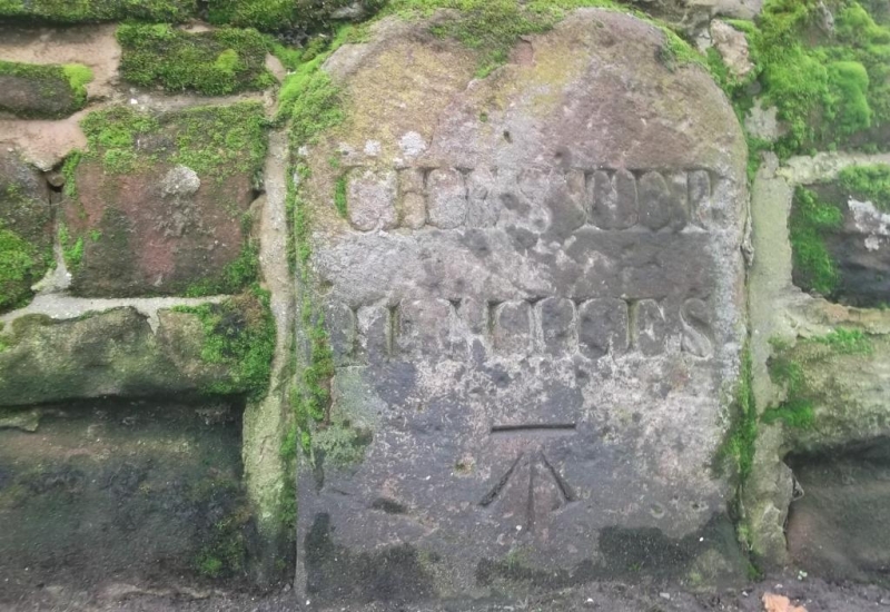
Mile stone. Possibly early C19. Inscribed "CHESTER/
11 MILES", Benchmark below and partially obscured "BROMBRO"
to base.
Listing NGR: SJ3499082367
External links are from the relevant listing authority and, where applicable, Wikidata. Wikidata IDs may be related buildings as well as this specific building. If you want to add or update a link, you will need to do so by editing the Wikidata entry.


Other nearby listed buildings
