Approximate Location Map
Large Map »
Latitude: 53.3477 / 53°20'51"N
Longitude: -3.0035 / 3°0'12"W
OS Eastings: 333291
OS Northings: 383892
OS Grid: SJ332838
Mapcode National: GBR 7YGQ.JN
Mapcode Global: WH87L.T3YX
Plus Code: 9C5R8XXW+3H
Entry Name: Sundial Approximately 13.5 Metres to South of St Andrews Church
Listing Date: 2 December 1986
Grade: II
Source: Historic England
Source ID: 1075463
English Heritage Legacy ID: 215384
ID on this website: 101075463
Location: St Andrew's Church, Lower Bebington, Wirral, Merseyside, CH63
County: Wirral
Electoral Ward/Division: Clatterbridge
Parish: Non Civil Parish
Built-Up Area: Bebington
Traditional County: Cheshire
Lieutenancy Area (Ceremonial County): Merseyside
Church of England Parish: Bebington St Andrew
Church of England Diocese: Chester
Tagged with: Sundial
BEBINGTON CHURCH ROAD
SJ 38 SW
(south side)
Lower Bebington
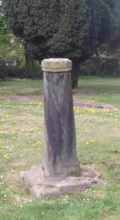
6/65 Sundial approx.
13.5m. to south
of St. Andrew's
Church
G.V. II
Sundial. Possibly 1764. Stone. Chamfered shaft with
octagonal cap; brass plate and gnomon.
Listing NGR: SJ3329183892
External links are from the relevant listing authority and, where applicable, Wikidata. Wikidata IDs may be related buildings as well as this specific building. If you want to add or update a link, you will need to do so by editing the Wikidata entry.


Other nearby listed buildings
