Approximate Location Map
Large Map »
Latitude: 53.4793 / 53°28'45"N
Longitude: -2.9379 / 2°56'16"W
OS Eastings: 337853
OS Northings: 398471
OS Grid: SJ378984
Mapcode National: GBR 7XX6.RH
Mapcode Global: WH86V.VT62
Plus Code: 9C5VF3H6+PR
Entry Name: Blue Anchor Bridge
Listing Date: 17 January 1986
Grade: II
Source: Historic England
Source ID: 1343295
English Heritage Legacy ID: 216400
ID on this website: 101343295
Location: Aintree, Sefton, Merseyside, L9
County: Sefton
Civil Parish: Aintree Village
Built-Up Area: Liverpool
Traditional County: Lancashire
Lieutenancy Area (Ceremonial County): Merseyside
Church of England Parish: Aintree St Giles with St Peter
Church of England Diocese: Liverpool
Tagged with: Bridge
AINTREE MELLING ROAD
SJ 93 NW
(north-east side)
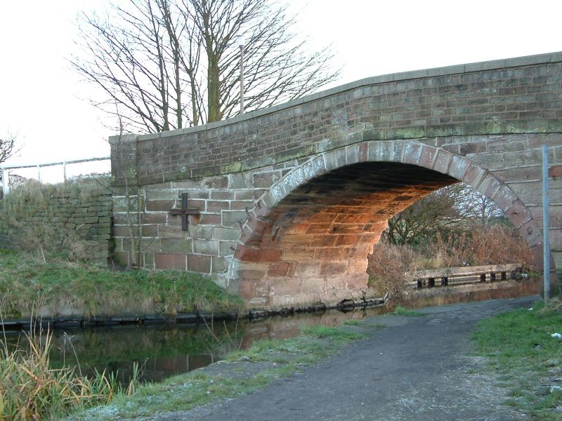
10/1 Blue Anchor
- Bridge
- II
Bridge over Leeds and Liverpool Canal. Dated on keystone,
1831. Stone. Elliptical arch with rusticated voussoirs;
end piers. Raised band and parapet with coping.
Listing NGR: SJ3785398471
External links are from the relevant listing authority and, where applicable, Wikidata. Wikidata IDs may be related buildings as well as this specific building. If you want to add or update a link, you will need to do so by editing the Wikidata entry.


Other nearby listed buildings
