Approximate Location Map
Large Map »
Latitude: 53.5658 / 53°33'57"N
Longitude: -3.0595 / 3°3'34"W
OS Eastings: 329923
OS Northings: 408213
OS Grid: SD299082
Mapcode National: GBR 7W26.FG
Mapcode Global: WH758.ZM7Q
Plus Code: 9C5RHW8R+85
Entry Name: 21, Green Lane
Listing Date: 19 July 1966
Grade: II
Source: Historic England
Source ID: 1199044
English Heritage Legacy ID: 216434
ID on this website: 101199044
Location: Freshfield, Sefton, Merseyside, L37
County: Sefton
Civil Parish: Formby
Built-Up Area: Formby
Traditional County: Lancashire
Lieutenancy Area (Ceremonial County): Merseyside
Church of England Parish: Formby St Peter
Church of England Diocese: Liverpool
Tagged with: Building
SD 20 NE
2/37
FORMBY
GREEN LANE (west side)
No. 21
19.7.66
GV
II
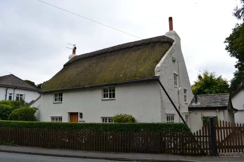
House. C18 with alterations. Roughcast with thatch. 2
storeys, 2 bays. Ground floor 3-light and 1st floor 2-light
horizontally-sliding sashes with glazing bars. C20 central
entrance. Timber gutter with sloping open down spout.
Coped gables and end stacks. C20 gabled porch to right
return.
Listing NGR: SD2992308213
External links are from the relevant listing authority and, where applicable, Wikidata. Wikidata IDs may be related buildings as well as this specific building. If you want to add or update a link, you will need to do so by editing the Wikidata entry.


Other nearby listed buildings
