Approximate Location Map
Large Map »
Latitude: 52.5645 / 52°33'52"N
Longitude: -1.8213 / 1°49'16"W
OS Eastings: 412211
OS Northings: 296316
OS Grid: SP122963
Mapcode National: GBR 3K9.DK
Mapcode Global: WHCH8.0S0T
Plus Code: 9C4WH57H+RF
Entry Name: Church House
Listing Date: 18 October 1949
Grade: II
Source: Historic England
Source ID: 1116424
English Heritage Legacy ID: 216556
ID on this website: 101116424
Location: Royal Sutton Coldfield, Birmingham, West Midlands, B72
County: Birmingham
Civil Parish: Sutton Coldfield
Built-Up Area: Sutton Coldfield
Traditional County: Warwickshire
Lieutenancy Area (Ceremonial County): West Midlands
Church of England Parish: Sutton Coldfield Holy Trinity
Church of England Diocese: Birmingham
Tagged with: House
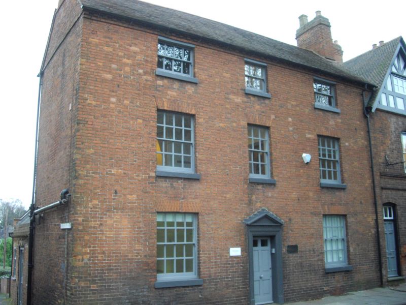
1.
5104 COLESHILL STREET
(East Side)
No 15
(Church House)
SP 1296 1/34 18.10.49
II
2.
Late C18 or early C19. Red brick, tiled roof with brick modillioned cornice.
3 storeys, 3 sash windows with glazing bars under flat arches. Wooden door surround
with pediment.
Listing NGR: SP1221096319
External links are from the relevant listing authority and, where applicable, Wikidata. Wikidata IDs may be related buildings as well as this specific building. If you want to add or update a link, you will need to do so by editing the Wikidata entry.


Other nearby listed buildings
