Approximate Location Map
Large Map »
Latitude: 52.5663 / 52°33'58"N
Longitude: -1.823 / 1°49'22"W
OS Eastings: 412092
OS Northings: 296510
OS Grid: SP120965
Mapcode National: GBR 3K8.0Y
Mapcode Global: WHCH7.ZR2H
Plus Code: 9C4WH58G+GQ
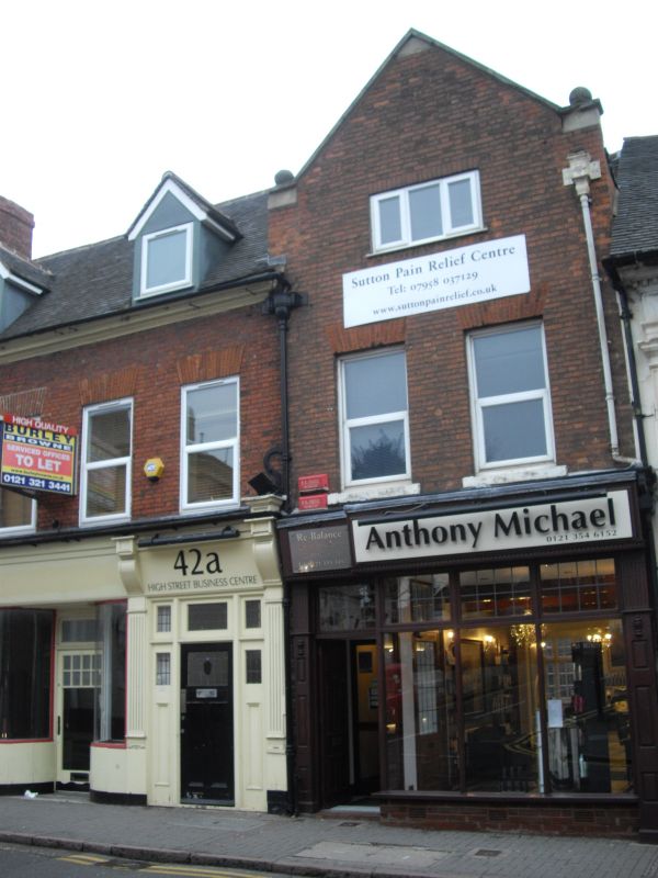
Entry Name: 42, High Street
Listing Date: 26 August 1976
Grade: II
Source: Historic England
Source ID: 1343310
English Heritage Legacy ID: 216581
ID on this website: 101343310
Location: Royal Sutton Coldfield, Birmingham, West Midlands, B72
County: Birmingham
Civil Parish: Sutton Coldfield
Built-Up Area: Sutton Coldfield
Traditional County: Warwickshire
Lieutenancy Area (Ceremonial County): West Midlands
Church of England Parish: Sutton Coldfield Holy Trinity
Church of England Diocese: Birmingham
Tagged with: Building
1.
5140 HIGH STREET
(East Side)
No 42
SP 1296 1/37
II GV
2.
Late C18. Red brick, machine tiled roof with 2 gabled dormers and stone cornice
moulding. 2 storeys and attics, 4 sash windows under flat arches. C19 shop
front with cornice.
Nos 42 to 52 (even) and No 56 form a group.
Listing NGR: SP1209996516
External links are from the relevant listing authority and, where applicable, Wikidata. Wikidata IDs may be related buildings as well as this specific building. If you want to add or update a link, you will need to do so by editing the Wikidata entry.


Other nearby listed buildings
