Approximate Location Map
Large Map »
Latitude: 52.542 / 52°32'31"N
Longitude: -1.7998 / 1°47'59"W
OS Eastings: 413675
OS Northings: 293808
OS Grid: SP136938
Mapcode National: GBR 3QK.3N
Mapcode Global: VH9YR.RCDP
Plus Code: 9C4WG6R2+Q3
Entry Name: Walmley Almshouses (4)
Listing Date: 23 January 1976
Grade: II
Source: Historic England
Source ID: 1116225
English Heritage Legacy ID: 216630
ID on this website: 101116225
Location: Walmley, Birmingham, West Midlands, B76
County: Birmingham
Civil Parish: Sutton Coldfield
Built-Up Area: Sutton Coldfield
Traditional County: Warwickshire
Lieutenancy Area (Ceremonial County): West Midlands
Church of England Parish: Walmley
Church of England Diocese: Birmingham
Tagged with: Almshouse
1.
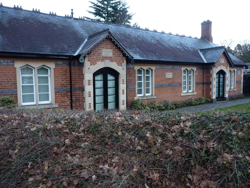
5104 WALMLEY ROAD
(East Side)
Walmley Almshouses (4)
SP 19 SW 3/129 23.1.76.
II
2.
1863 with pair of porches inscribed J Riland and Ann Webb. Red brick, purple
brick bands and plinth, flush stone quoins and dressings. Welsh slated roof
with ornamental bargeboards and crestings. 1 storey, 4 stone mullion 2-light
casements.
Listing NGR: SP1367593808
External links are from the relevant listing authority and, where applicable, Wikidata. Wikidata IDs may be related buildings as well as this specific building. If you want to add or update a link, you will need to do so by editing the Wikidata entry.


Other nearby listed buildings
