Approximate Location Map
Large Map »
Latitude: 52.4732 / 52°28'23"N
Longitude: -1.9371 / 1°56'13"W
OS Eastings: 404369
OS Northings: 286137
OS Grid: SP043861
Mapcode National: GBR 5RC.5B
Mapcode Global: VH9Z2.C3SD
Plus Code: 9C4WF3F7+75
Entry Name: 14, Clarendon Road B16
Listing Date: 8 July 1982
Grade: II
Source: Historic England
Source ID: 1075627
English Heritage Legacy ID: 216966
ID on this website: 101075627
Location: Rotton Park, Birmingham, West Midlands, B16
County: Birmingham
Parish: Non Civil Parish
Built-Up Area: Birmingham
Traditional County: Warwickshire
Lieutenancy Area (Ceremonial County): West Midlands
Church of England Parish: Edgbaston St Augustine
Church of England Diocese: Birmingham
Tagged with: Building
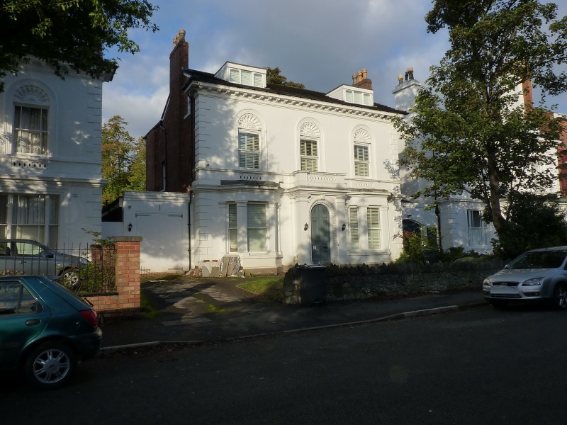
CLARENDON ROAD
1.
5104
Edgbaston B16
No 14
SF 0486 SW 35/10
II GV
2.
Circa 1855 three bay stucco 2 storey villa of same design as No 12 but with stucco
canted bay window to ground floor. The door architrave is here decorated with
anthemia with similar motifs to panelled spandrels. Part of a group of 3 similar
villas.
Listing NGR: SP0436986137
External links are from the relevant listing authority and, where applicable, Wikidata. Wikidata IDs may be related buildings as well as this specific building. If you want to add or update a link, you will need to do so by editing the Wikidata entry.


Other nearby listed buildings
