Approximate Location Map
Large Map »
Latitude: 52.4479 / 52°26'52"N
Longitude: -1.5835 / 1°35'0"W
OS Eastings: 428402
OS Northings: 283408
OS Grid: SP284834
Mapcode National: GBR 5K6.GGY
Mapcode Global: VHBWQ.HQQT
Plus Code: 9C4WCCX8+5H
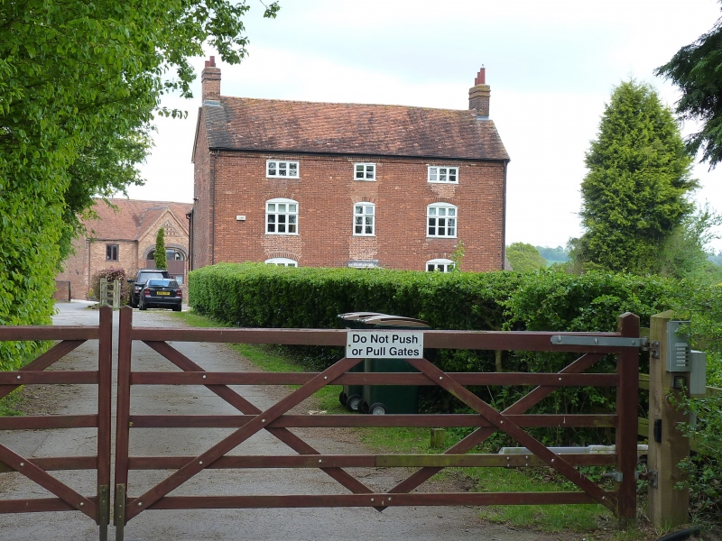
Entry Name: Oaklands Farmhouse
Listing Date: 9 January 1987
Grade: II
Source: Historic England
Source ID: 1076054
English Heritage Legacy ID: 217887
ID on this website: 101076054
Location: Harvest Hill, Coventry, West Midlands, CV5
County: Coventry
Civil Parish: Allesley
Traditional County: Warwickshire
Lieutenancy Area (Ceremonial County): West Midlands
Church of England Parish: Allesley All Saints
Church of England Diocese: Coventry
Tagged with: Farmhouse
ALLESLEY CP CLAY LANE
SP 28 SE
1/5 Oaklands Farmhouse
- II
House. Early C19. Brick with tile roof. Three storeys, three bays.
windows are timber casements. Those on the ground and first floors have
segmental heads. Door, in middle bay, has timber hood on brackets. Gable
chimneys.
Listing NGR: SP2840283408
External links are from the relevant listing authority and, where applicable, Wikidata. Wikidata IDs may be related buildings as well as this specific building. If you want to add or update a link, you will need to do so by editing the Wikidata entry.


Other nearby listed buildings
