Approximate Location Map
Large Map »
Latitude: 52.405 / 52°24'17"N
Longitude: -1.7076 / 1°42'27"W
OS Eastings: 419989
OS Northings: 278589
OS Grid: SP199785
Mapcode National: GBR 4J9.73B
Mapcode Global: VHBWV.CT37
Plus Code: 9C4WC73R+XX
Entry Name: Barn at the Firs
Listing Date: 22 July 1976
Grade: II
Source: Historic England
Source ID: 1075958
English Heritage Legacy ID: 218055
ID on this website: 101075958
Location: Eastcote, Solihull, West Midlands, B92
County: Solihull
Civil Parish: Barston
Traditional County: Warwickshire
Lieutenancy Area (Ceremonial County): West Midlands
Church of England Parish: Barston
Church of England Diocese: Birmingham
Tagged with: Barn
1.
5108
SP 17 NE
3/172
BARSTON
BARSTON LANE
(North Side)
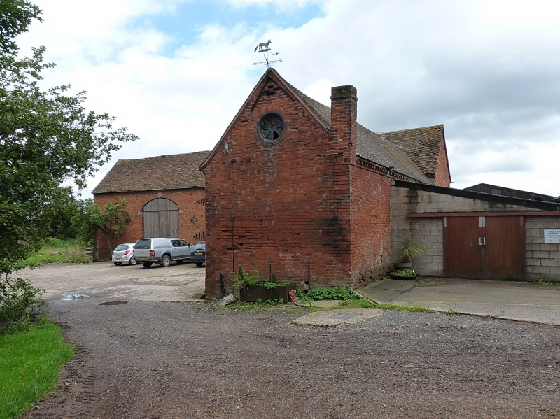
Barn at The Firs
II
GV
2.
C18. Red brick, tiled roof. L plan, diamond chequer pattern of ventilation holes.
2 segmental archways with keystones and stone imposts. Round arched gable window.
Included for group value.
The Firs, Barn and Gate Piers at The Firs form a group.
Listing NGR: SP1998978589
External links are from the relevant listing authority and, where applicable, Wikidata. Wikidata IDs may be related buildings as well as this specific building. If you want to add or update a link, you will need to do so by editing the Wikidata entry.


Other nearby listed buildings
