Approximate Location Map
Large Map »
Latitude: 52.3996 / 52°23'58"N
Longitude: -1.6972 / 1°41'49"W
OS Eastings: 420698
OS Northings: 278002
OS Grid: SP206780
Mapcode National: GBR 4J9.HQR
Mapcode Global: VHBWV.JYM9
Plus Code: 9C4W98X3+V4
Entry Name: The Vicarage
Listing Date: 22 July 1976
Grade: II
Source: Historic England
Source ID: 1075963
English Heritage Legacy ID: 218066
ID on this website: 101075963
Location: Barston, Solihull, West Midlands, B92
County: Solihull
Civil Parish: Barston
Traditional County: Warwickshire
Lieutenancy Area (Ceremonial County): West Midlands
Church of England Parish: Barston
Church of England Diocese: Birmingham
Tagged with: Clergy house
BARSTON BARSTON LANE
1.
(South Side)
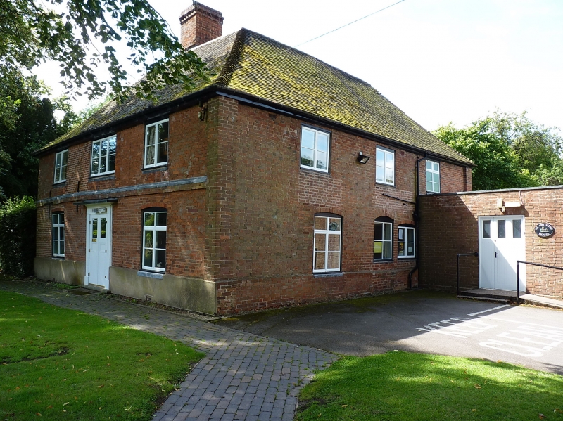
SP 2078 17/189 The Vicarage
II GV
2.
C18. Red brick, hipped tiled roof. 2 storeys, Ist floor band. 3 flush casement
windows. 6 panel door, 2 panels now glazed, 2 fold in early C19 incised surround
under hood.
The Vicarage and Church of Saint Swithin form a group with the Medieval Cross.
Listing NGR: SP2069878002
External links are from the relevant listing authority and, where applicable, Wikidata. Wikidata IDs may be related buildings as well as this specific building. If you want to add or update a link, you will need to do so by editing the Wikidata entry.


Other nearby listed buildings
