Approximate Location Map
Large Map »
Latitude: 52.3996 / 52°23'58"N
Longitude: -1.6962 / 1°41'46"W
OS Eastings: 420767
OS Northings: 277998
OS Grid: SP207779
Mapcode National: GBR 4J9.HZG
Mapcode Global: VHBWV.KY4B
Plus Code: 9C4W98X3+RG
Entry Name: Medieval Cross in Saint Swithin's Churchyard
Listing Date: 22 July 1976
Grade: II
Source: Historic England
Source ID: 1045838
English Heritage Legacy ID: 218068
ID on this website: 101045838
Location: St Swithin's Church, Barston, Solihull, West Midlands, B92
County: Solihull
Civil Parish: Barston
Traditional County: Warwickshire
Lieutenancy Area (Ceremonial County): West Midlands
Church of England Parish: Barston
Church of England Diocese: Birmingham
Tagged with: High cross
BARSTON BARSTON LANE
1.
5108
(South Side)
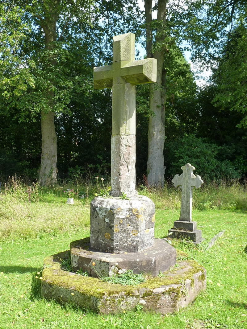
Medieval Cross in
Saint Swithin's Churchyard
SP 2078 17/191
II GV
2.
Medieval square base and 2 octagonal steps with modern shaft and cross head.
The Vicarage and Church of Saint Swithin form a group with the Medieval Cross.
Listing NGR: SP2076677999
External links are from the relevant listing authority and, where applicable, Wikidata. Wikidata IDs may be related buildings as well as this specific building. If you want to add or update a link, you will need to do so by editing the Wikidata entry.


Other nearby listed buildings
