Approximate Location Map
Large Map »
Latitude: 52.4346 / 52°26'4"N
Longitude: -1.6376 / 1°38'15"W
OS Eastings: 424732
OS Northings: 281907
OS Grid: SP247819
Mapcode National: GBR 5KB.6SZ
Mapcode Global: VHBWW.K2MG
Plus Code: 9C4WC9M6+RW
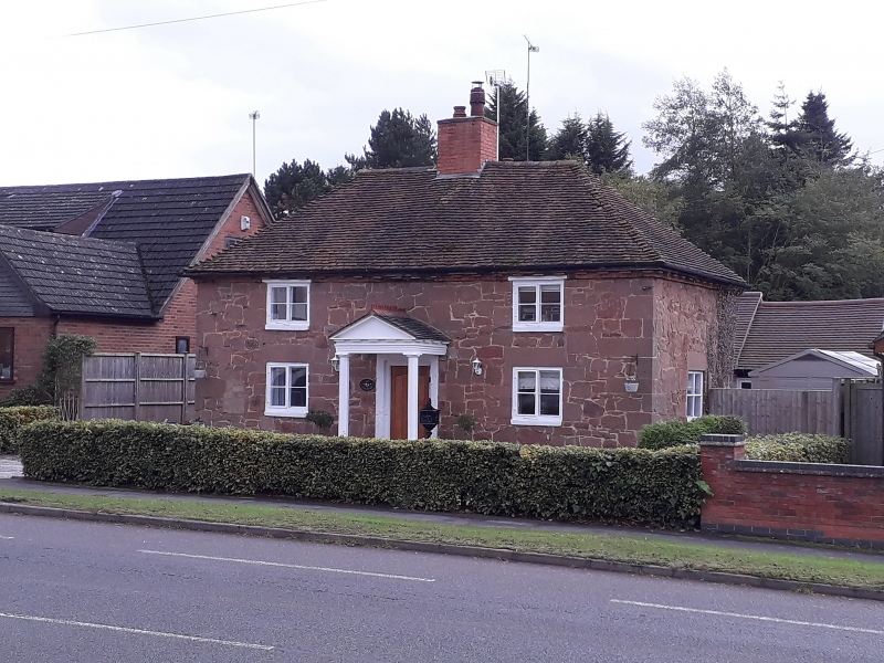
Entry Name: The Elms
Listing Date: 22 July 1976
Grade: II
Source: Historic England
Source ID: 1352660
English Heritage Legacy ID: 218224
ID on this website: 101352660
Location: Meriden, Solihull, West Midlands, CV7
County: Solihull
Civil Parish: Meriden
Built-Up Area: Meriden
Traditional County: Warwickshire
Lieutenancy Area (Ceremonial County): West Midlands
Church of England Parish: Meriden St Laurence
Church of England Diocese: Coventry
Tagged with: Architectural structure
BIRMINGHAM ROAD
1.
5108 MERIDEN
(South-West Side)
The Elms
SP 28 SW 15/375
II
2.
C18. Ashlar dressed random rubble, hipped old tiled roof. 2 storeys, 2 casement
windows. Doric porch.
Listing NGR: SP2473281907
External links are from the relevant listing authority and, where applicable, Wikidata. Wikidata IDs may be related buildings as well as this specific building. If you want to add or update a link, you will need to do so by editing the Wikidata entry.


Other nearby listed buildings
