Approximate Location Map
Large Map »
Latitude: 52.4511 / 52°27'3"N
Longitude: -1.6134 / 1°36'48"W
OS Eastings: 426370
OS Northings: 283751
OS Grid: SP263837
Mapcode National: GBR 5K5.6Y5
Mapcode Global: VHBWP.ZNFC
Plus Code: 9C4WF92P+CJ
Entry Name: Stonehouse Farmhouse
Listing Date: 22 July 1976
Grade: II
Source: Historic England
Source ID: 1031812
English Heritage Legacy ID: 218235
ID on this website: 101031812
Location: Hollyberry End, Solihull, West Midlands, CV7
County: Solihull
Civil Parish: Meriden
Traditional County: Warwickshire
Lieutenancy Area (Ceremonial County): West Midlands
Church of England Parish: Meriden St Laurence
Church of England Diocese: Coventry
Tagged with: Farmhouse
HARVEST HILL LANE
1.
5108 MERIDEN
(North-West Side)
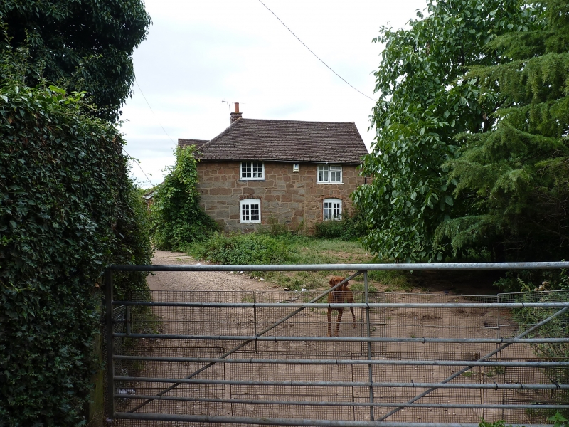
Stonehouse Farmhouse
SP 28 SE 16/387
II
2.
C17, much altered. Coursed and random rubble, machine tiled hipped roof with small
gable to front. 2 storeys, 2 flush casement windows with glazing bars.
Listing NGR: SP2637083751
External links are from the relevant listing authority and, where applicable, Wikidata. Wikidata IDs may be related buildings as well as this specific building. If you want to add or update a link, you will need to do so by editing the Wikidata entry.


Other nearby listed buildings
