Approximate Location Map
Large Map »
Latitude: 52.387 / 52°23'13"N
Longitude: -1.7294 / 1°43'45"W
OS Eastings: 418512
OS Northings: 276587
OS Grid: SP185765
Mapcode National: GBR 4JG.7L9
Mapcode Global: VH9ZK.Z82G
Plus Code: 9C4W97PC+R6
Entry Name: 86-90, Kenilworth Road
Listing Date: 22 July 1976
Grade: II
Source: Historic England
Source ID: 1342849
English Heritage Legacy ID: 218278
ID on this website: 101342849
Location: Knowle, Solihull, West Midlands, B93
County: Solihull
Electoral Ward/Division: Knowle
Parish: Non Civil Parish
Built-Up Area: Solihull
Traditional County: Warwickshire
Lieutenancy Area (Ceremonial County): West Midlands
Church of England Parish: Knowle
Church of England Diocese: Birmingham
Tagged with: Building
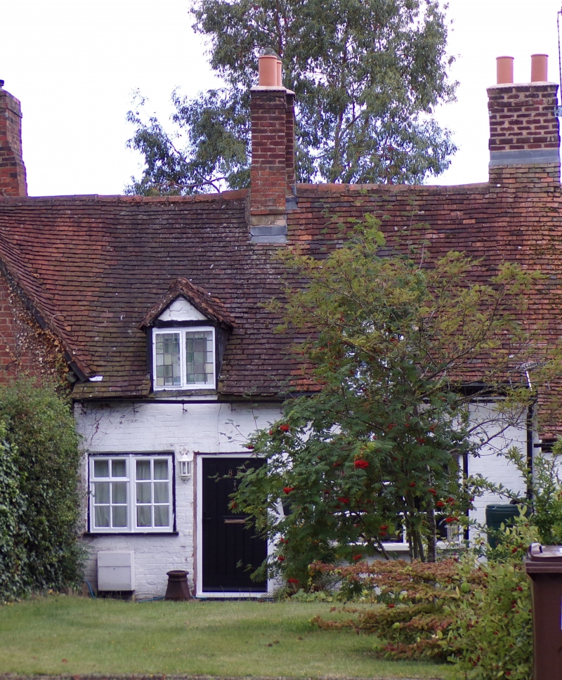
SOLIHULL KNOWLE
1.
5108
KENILWORTH ROAD
(South Side)
Nos 86 to 90 (even)
SP 1876 20/436
II GV
2.
Late C16 or early C17. Timber trade, whitewashed brick Dogging, red brick gable
on left. Tiled roof with dormer, 1 storey and attics, casement windows with glazing
bars.
Nos 74 to 90 (even) form a group.
Listing NGR: SP1851276587
External links are from the relevant listing authority and, where applicable, Wikidata. Wikidata IDs may be related buildings as well as this specific building. If you want to add or update a link, you will need to do so by editing the Wikidata entry.


Other nearby listed buildings
