Approximate Location Map
Large Map »
Latitude: 52.4237 / 52°25'25"N
Longitude: -1.7515 / 1°45'5"W
OS Eastings: 416995
OS Northings: 280662
OS Grid: SP169806
Mapcode National: GBR 4J1.204
Mapcode Global: VH9ZC.LBDV
Plus Code: 9C4WC6FX+FC
Entry Name: 239, Lugtrout Lane
Listing Date: 22 July 1976
Grade: II
Source: Historic England
Source ID: 1203343
English Heritage Legacy ID: 218284
ID on this website: 101203343
Location: Catherine-de-Barnes, Solihull, West Midlands, B91
County: Solihull
Electoral Ward/Division: Bickenhill
Parish: Hampton in Arden
Built-Up Area: Catherine-de-Barnes
Traditional County: Warwickshire
Lieutenancy Area (Ceremonial County): West Midlands
Church of England Parish: Hampton-in-Arden
Church of England Diocese: Birmingham
Tagged with: Building
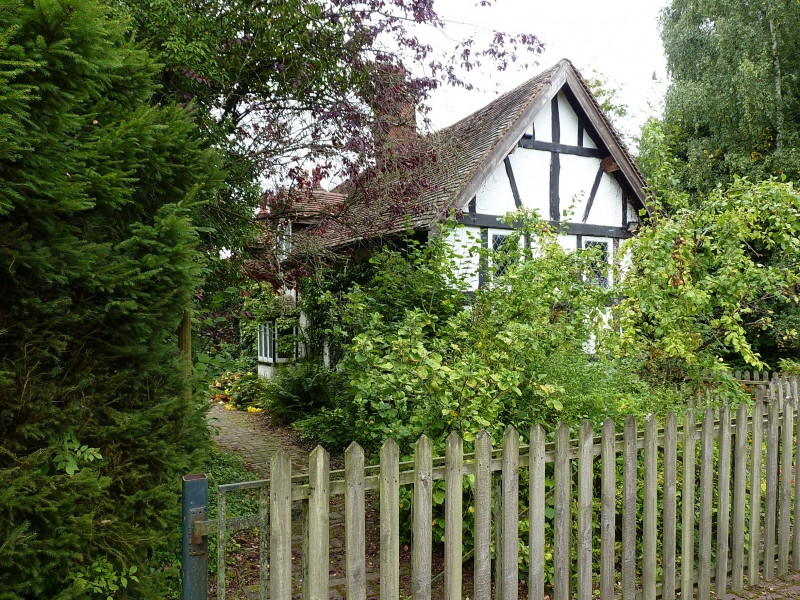
SOLIHULL LUGTROUT LANE
1.
5108
No 239
SP 18 SE 9/450
II
2.
C17 altered C19. Timber frame, red brick nogging, front wall largely rebuilt in
red brick. Tiled roof with gabled dormers. I storey and attics, casement windows
with glazing bars, modern canted bay window. Gabled wood C19 porch.
Listing NGR: SP1699580662
External links are from the relevant listing authority and, where applicable, Wikidata. Wikidata IDs may be related buildings as well as this specific building. If you want to add or update a link, you will need to do so by editing the Wikidata entry.


Other nearby listed buildings
