Approximate Location Map
Large Map »
Latitude: 52.3918 / 52°23'30"N
Longitude: -1.7391 / 1°44'20"W
OS Eastings: 417848
OS Northings: 277116
OS Grid: SP178771
Mapcode National: GBR 4JF.53F
Mapcode Global: VH9ZK.S4YS
Plus Code: 9C4W97R6+P8
Entry Name: 1587, Warwick Road
Listing Date: 22 July 1976
Grade: II
Source: Historic England
Source ID: 1342876
English Heritage Legacy ID: 218316
ID on this website: 101342876
Location: Knowle, Solihull, West Midlands, B93
County: Solihull
Electoral Ward/Division: Knowle
Parish: Non Civil Parish
Built-Up Area: Solihull
Traditional County: Warwickshire
Lieutenancy Area (Ceremonial County): West Midlands
Church of England Parish: Knowle
Church of England Diocese: Birmingham
Tagged with: Building
SOLIHULL KNOWLE
1.
5108
WARWICK ROAD
(North-East Side)
No 1587
SP 1777 21/38
II
2.
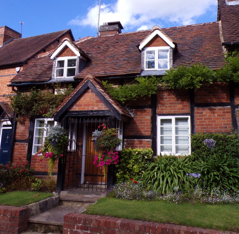
C17. Timber frame, red brick nogging, tiled roof with 2 gabled dormers. 1 storey
and attics, 2 flush casement windows with glazing bars. Modern gabled porch in keeping.
Listing NGR: SP1784877116
External links are from the relevant listing authority and, where applicable, Wikidata. Wikidata IDs may be related buildings as well as this specific building. If you want to add or update a link, you will need to do so by editing the Wikidata entry.


Other nearby listed buildings
