Approximate Location Map
Large Map »
Latitude: 52.3894 / 52°23'21"N
Longitude: -1.7353 / 1°44'7"W
OS Eastings: 418108
OS Northings: 276851
OS Grid: SP181768
Mapcode National: GBR 4JG.049
Mapcode Global: VH9ZK.V6YM
Plus Code: 9C4W97Q7+QV
Entry Name: 1622, Warwick Road
Listing Date: 22 July 1976
Grade: II
Source: Historic England
Source ID: 1203590
English Heritage Legacy ID: 218332
ID on this website: 101203590
Location: Knowle, Solihull, West Midlands, B93
County: Solihull
Electoral Ward/Division: Knowle
Parish: Non Civil Parish
Built-Up Area: Solihull
Traditional County: Warwickshire
Lieutenancy Area (Ceremonial County): West Midlands
Church of England Parish: Knowle
Church of England Diocese: Birmingham
Tagged with: Building
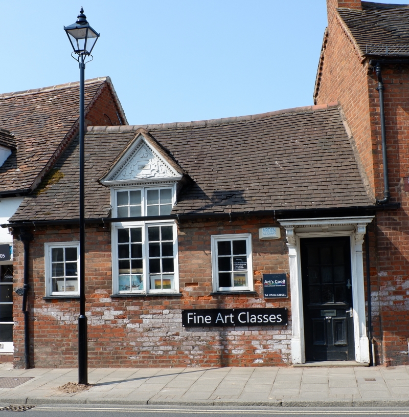
SOLIHULL KNOWLE
1.
5108
(High Street)
WARWICK ROAD
(South-West Side)
No 1622
SP 1876 20/423
II GV
2.
1886. Red brick, old tiled roof. 1 storey, 3 flush casements, glazing bars, central
tall pedimented window. Door surround; fluted half pilasters, hood on consoles.
Included for group value.
Nos 1622 to 1628 (even) form a group.
Listing NGR: SP1811276847
External links are from the relevant listing authority and, where applicable, Wikidata. Wikidata IDs may be related buildings as well as this specific building. If you want to add or update a link, you will need to do so by editing the Wikidata entry.


Other nearby listed buildings
