Approximate Location Map
Large Map »
Latitude: 52.4225 / 52°25'20"N
Longitude: -1.5076 / 1°30'27"W
OS Eastings: 433581
OS Northings: 280610
OS Grid: SP335806
Mapcode National: GBR HFG.TM
Mapcode Global: VHBWY.TCCS
Plus Code: 9C4WCFCR+XX
Entry Name: 64 to 94, Cash's Lane
Listing Date: 30 October 1972
Grade: II
Source: Historic England
Source ID: 1342923
English Heritage Legacy ID: 218457
ID on this website: 101342923
Location: Bishopgate Green, Coventry, West Midlands, CV1
County: Coventry
Electoral Ward/Division: Foleshill
Parish: Non Civil Parish
Built-Up Area: Coventry
Traditional County: Warwickshire
Lieutenancy Area (Ceremonial County): West Midlands
Church of England Parish: Foleshill St Paul
Church of England Diocese: Coventry
Tagged with: Building
1.
5105 CASH'S LANE
-----------
Nos 64 to 94 (even)
SP 38 SW 19/160 30.l0.72
II
2.
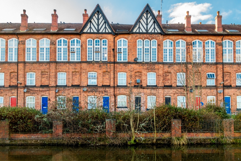
1857. Built as part of Cash's Model Factory. A terrace of 2 storey homes with
'topshops', designed to maintain the independence of the individual worker within the factory system. The terrace was originally of 30 units balanced with a gable at either end and 2 in centre. Now 16 units with 2 bargeboarded gables. Brick with tiled roofs, 3 storeys, units separated by buttresses ending in chimneys. Brick bands. Each unit of 2 bays with sashes, 1 blank window on upper floor. Plain doors. The weaving shops have large windows, brick mullions. Individual shops converted to 1 large factory 1861
Descriptive Notes should be amended to read.
2.
1857. Built as part of Cash's Model Factory. Formerly part of a continuous terrace, Nos 52 to 110. Now joined at top floor level only by gallery to Nos 52 to 58. Nos 60, 62 and 100 to 110 (even) destroyed by bombs in 1941. Terrace of 2 storey houses with third storey 'topshops', designed to maintain the independence of the individual worker within the factory system. Brick tiled roof with ornamental barge-boards to two formerly central gables. Shallow, wide buttresses between houses. Pointed arched windows: sashes to lower floors; top floor tall windows with mullions and transoms. Boarded doors under pointed arches. Individual shops converted to one large factory 1862
Nos 52 to 58 (even), 64 to 94 (even) and 112 to 140 (even) Cash's Lane form a group with
251 Kingfield Road.
------------------------------------
CASH'S LANE
1.
5105
Nos 64 to 94 (even)
SP 58 SW 19/160 30.10.72.
II
2.
1857. Built as part of Cash's Model Factory. A terrace of 2 storey homes with
'topshops', designed to maintain the independence of the individual worker within
the factory system. The terrace was originally of 50 units balanced with a gable
at either end and 2 in centre. Now 16 units with 2 bargeboarded gables. Brick
with tiled roofs. 3 storeys, units separated by buttresses ending in chimneys.
Brick bands. Each unit of 2 bays with sashes, 1 blank window on upper floor.
Plain doors. The weaving shops have large windows, brick mullions. Individual
shops converted to 1 large factory 1862.
Listing NGR: SP3358180609
External links are from the relevant listing authority and, where applicable, Wikidata. Wikidata IDs may be related buildings as well as this specific building. If you want to add or update a link, you will need to do so by editing the Wikidata entry.


Other nearby listed buildings
