Approximate Location Map
Large Map »
Latitude: 52.4021 / 52°24'7"N
Longitude: -1.5 / 1°29'59"W
OS Eastings: 434115
OS Northings: 278347
OS Grid: SP341783
Mapcode National: GBR HHP.HY
Mapcode Global: VHBWY.YWCF
Plus Code: 9C4WCG22+R2
Entry Name: Cemetery Gazebo
Listing Date: 24 June 1974
Grade: II
Source: Historic England
Source ID: 1076623
English Heritage Legacy ID: 218519
ID on this website: 101076623
Location: Coventry, West Midlands, CV1
County: Coventry
Electoral Ward/Division: St Michael's
Parish: Non Civil Parish
Built-Up Area: Coventry
Traditional County: Warwickshire
Lieutenancy Area (Ceremonial County): West Midlands
Church of England Parish: Coventry, All Saints
Church of England Diocese: Coventry
Tagged with: Building
5105
SP 37 NW 17/341
LONDON ROAD
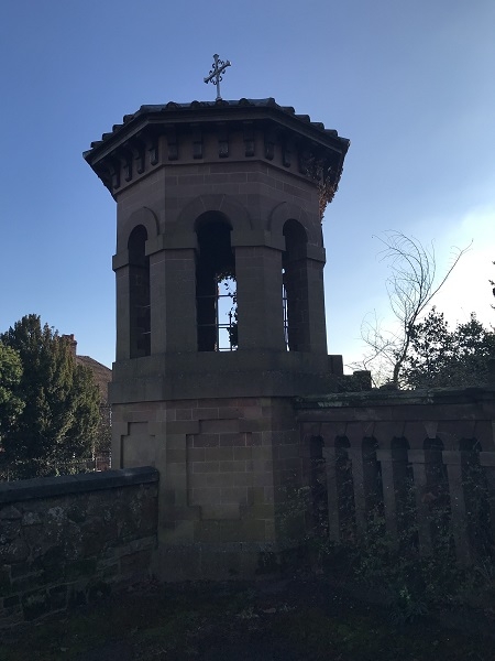
Cemetery Gazebo
II
GV
Mid C19 Italianate. Octagonal arcaded structure in sandstone. Panelled tall plinth. Stone steps up. Flat roof.
All the listed buildings in the Cemetery form a group.
This entry was subject to a Minor Amendment on 22 August 2019.
External links are from the relevant listing authority and, where applicable, Wikidata. Wikidata IDs may be related buildings as well as this specific building. If you want to add or update a link, you will need to do so by editing the Wikidata entry.


Other nearby listed buildings
