Approximate Location Map
Large Map »
Latitude: 52.4011 / 52°24'3"N
Longitude: -1.5005 / 1°30'1"W
OS Eastings: 434081
OS Northings: 278235
OS Grid: SP340782
Mapcode National: GBR HHQ.D9
Mapcode Global: VHBWY.YX36
Plus Code: 9C4WCF2X+CR
Entry Name: Cemetery Chapel
Listing Date: 24 June 1974
Grade: II
Source: Historic England
Source ID: 1318898
English Heritage Legacy ID: 218520
ID on this website: 101318898
Location: Coventry, West Midlands, CV1
County: Coventry
Electoral Ward/Division: St Michael's
Parish: Non Civil Parish
Built-Up Area: Coventry
Traditional County: Warwickshire
Lieutenancy Area (Ceremonial County): West Midlands
Church of England Parish: Coventry, All Saints
Church of England Diocese: Coventry
Tagged with: Chapel
5105
SP 37 NW 17/342
LONDON ROAD
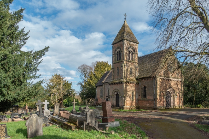
Cemetery Chapel
II
GV
Mid C19. Norman style in stone with tiled roof. Nave, chancel, north porch under tower with small spire. Carved door and window arches including west rose window in gable.
All the listed buildings in the Cemetery form a group.
This entry was subject to a Minor Amendment on 7 November 2019.
External links are from the relevant listing authority and, where applicable, Wikidata. Wikidata IDs may be related buildings as well as this specific building. If you want to add or update a link, you will need to do so by editing the Wikidata entry.


Other nearby listed buildings
