Approximate Location Map
Large Map »
Latitude: 52.4006 / 52°24'2"N
Longitude: -1.4991 / 1°29'56"W
OS Eastings: 434179
OS Northings: 278183
OS Grid: SP341781
Mapcode National: GBR HHQ.PG
Mapcode Global: VHBWY.YXWL
Plus Code: 9C4WCG22+69
Entry Name: Terrace Walls to the Cemetery
Listing Date: 24 June 1974
Grade: II
Source: Historic England
Source ID: 1145882
English Heritage Legacy ID: 218523
ID on this website: 101145882
Location: Coventry, West Midlands, CV1
County: Coventry
Electoral Ward/Division: St Michael's
Parish: Non Civil Parish
Built-Up Area: Coventry
Traditional County: Warwickshire
Lieutenancy Area (Ceremonial County): West Midlands
Church of England Parish: Coventry, All Saints
Church of England Diocese: Coventry
Tagged with: Wall
5105
SP 37 NW 17/345
LONDON ROAD
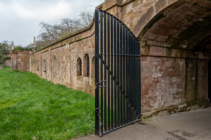
Terrace Walls to The Cemetery
II
GV
Circa 1847, an important part of the layout by (Sir) Joseph Paxton. Tall sandstone retaining walls carrying walk. Central archway.
All the listed buildings in the Cemetery form a group.
This entry was subject to a Minor Amendment on 28 October 2019.
External links are from the relevant listing authority and, where applicable, Wikidata. Wikidata IDs may be related buildings as well as this specific building. If you want to add or update a link, you will need to do so by editing the Wikidata entry.


Other nearby listed buildings
