Approximate Location Map
Large Map »
Latitude: 52.4099 / 52°24'35"N
Longitude: -1.5166 / 1°30'59"W
OS Eastings: 432976
OS Northings: 279209
OS Grid: SP329792
Mapcode National: GBR HCM.T4
Mapcode Global: VHBWY.NPKF
Plus Code: 9C4WCF5M+X8
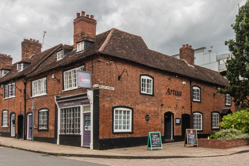
Entry Name: 1 and 3 Ryley Street
Listing Date: 24 June 1974
Grade: II
Source: Historic England
Source ID: 1076598
English Heritage Legacy ID: 218557
ID on this website: 101076598
Location: Draper's Fields, Coventry, West Midlands, CV1
County: Coventry
Electoral Ward/Division: St Michael's
Parish: Non Civil Parish
Built-Up Area: Coventry
Traditional County: Warwickshire
Lieutenancy Area (Ceremonial County): West Midlands
Church of England Parish: Coventry St John Baptist
Church of England Diocese: Coventry
Tagged with: Building
SP 3279 SE 3/347
5105
RYLEY STREET
Nos 1 & 3
II
GV
Late C18. Red brick, old tiled roof. Two storeys. Ground floor three light, 1st floor two light casement windows under segmental arches.
Included for group value.
Forms a group with Nos 34 to 44 (even) Hill Street.
This entry was subject to a Minor Amendment on 11 March 2019.
External links are from the relevant listing authority and, where applicable, Wikidata. Wikidata IDs may be related buildings as well as this specific building. If you want to add or update a link, you will need to do so by editing the Wikidata entry.


Other nearby listed buildings
