Approximate Location Map
Large Map »
Latitude: 52.6808 / 52°40'50"N
Longitude: 0.9383 / 0°56'17"E
OS Eastings: 598720
OS Northings: 313284
OS Grid: TF987132
Mapcode National: GBR SBJ.XQR
Mapcode Global: WHLRY.DW16
Plus Code: 9F42MWJQ+88
Entry Name: Detached bell tower
Listing Date: 1 August 1972
Grade: II
Source: Historic England
Source ID: 1077105
English Heritage Legacy ID: 219394
ID on this website: 101077105
Location: Dereham, Breckland, Norfolk, NR19
County: Norfolk
District: Breckland
Civil Parish: Dereham
Built-Up Area: Dereham
Traditional County: Norfolk
Lieutenancy Area (Ceremonial County): Norfolk
Church of England Parish: East Dereham
Church of England Diocese: Norwich
Tagged with: Building
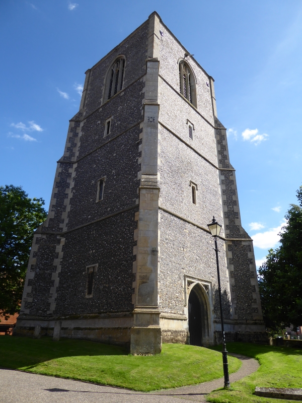
TF 9813 2/1.a
CHURCH STREET (south side)
Detached bell tower
II
To the south east of the Church of St Nicholas. Early C16. Built in four stages, of flints with stone quoins and stringcourses. No parapet. Diagonal buttresses at angles. West door.
Listing NGR: TF9872013284
External links are from the relevant listing authority and, where applicable, Wikidata. Wikidata IDs may be related buildings as well as this specific building. If you want to add or update a link, you will need to do so by editing the Wikidata entry.


Other nearby listed buildings
