Approximate Location Map
Large Map »
Latitude: 52.7371 / 52°44'13"N
Longitude: 1.1144 / 1°6'51"E
OS Eastings: 610350
OS Northings: 320047
OS Grid: TG103200
Mapcode National: GBR TCJ.DKK
Mapcode Global: WHLRV.2GYJ
Plus Code: 9F43P4P7+RQ
Entry Name: Church of St Mary
Listing Date: 10 May 1961
Grade: I
Source: Historic England
Source ID: 1076900
English Heritage Legacy ID: 219931
ID on this website: 101076900
Location: St Mary's Church, Broadland, Norfolk, NR9
County: Norfolk
District: Broadland
Civil Parish: Great Witchingham
Traditional County: Norfolk
Lieutenancy Area (Ceremonial County): Norfolk
Church of England Parish: Great with Little Witchingham
Church of England Diocese: Norwich
Tagged with: Church building
TG 12 SW GREAT WITCHINGHAM CHURCH ROAD
4/24 Church of St Mary
10.5.61
GV I
Parish church. West tower, south porch, nave, north and south aisles, south
transept and Chancel. C14 and C15. Flint, partly plastered, with stone
dressings. Pantiled roofs to Nave, Chancel and south porch, copper roofs to
aisles. C14 west tower with angle buttresses flushwork base course and two
ogee-headed niches flanking the west window. West doorway blocked. C15 clere-
storey of eight bays, westernmost bay blank with flushwork panels.
Diaper brickwork on south side. C15 south porch with two flushwork friezes of
crowned 'M's and carvings of the Annunciation in the spandrels of the doorway
arch, C14 arcades of four bays with octagonal piers and double-chamfered arches.
Good arch-braced nave roof with wall posts on stone corbels. Traceried cornice,
with eastern bay of roof panelled to form canopy of honour over rood. Plain
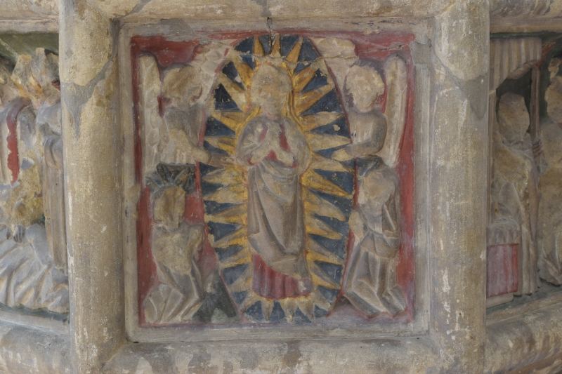
arch-braced roofs over aisles. Fine seven-sacrament font retaining much original
colouring. Four benches with pierced and traceried backs and poppy-heads.
Royal arms of Charles II given by Oliver le Neve 1660.
Listing NGR: TG1035020047
External links are from the relevant listing authority and, where applicable, Wikidata. Wikidata IDs may be related buildings as well as this specific building. If you want to add or update a link, you will need to do so by editing the Wikidata entry.


Other nearby listed buildings
