Approximate Location Map
Large Map »
Latitude: 52.6036 / 52°36'12"N
Longitude: 0.3801 / 0°22'48"E
OS Eastings: 561279
OS Northings: 303305
OS Grid: TF612033
Mapcode National: GBR N5G.LYH
Mapcode Global: WHJPS.TT6D
Plus Code: 9F42J93J+C3
Entry Name: Church of St Edmund
Listing Date: 24 February 1949
Grade: I
Source: Historic England
Source ID: 1342608
English Heritage Legacy ID: 221063
ID on this website: 101342608
Location: St Edmund's Church, Downham Market, King's Lynn and West Norfolk, Norfolk, PE38
County: Norfolk
District: King's Lynn and West Norfolk
Civil Parish: Downham Market
Built-Up Area: Downham Market
Traditional County: Norfolk
Lieutenancy Area (Ceremonial County): Norfolk
Church of England Parish: Downham Market
Church of England Diocese: Ely
Tagged with: Church building
TF 60 SW DOWNHAM MARKET
807/2/1 Church of St Edmund
24.2.49 I
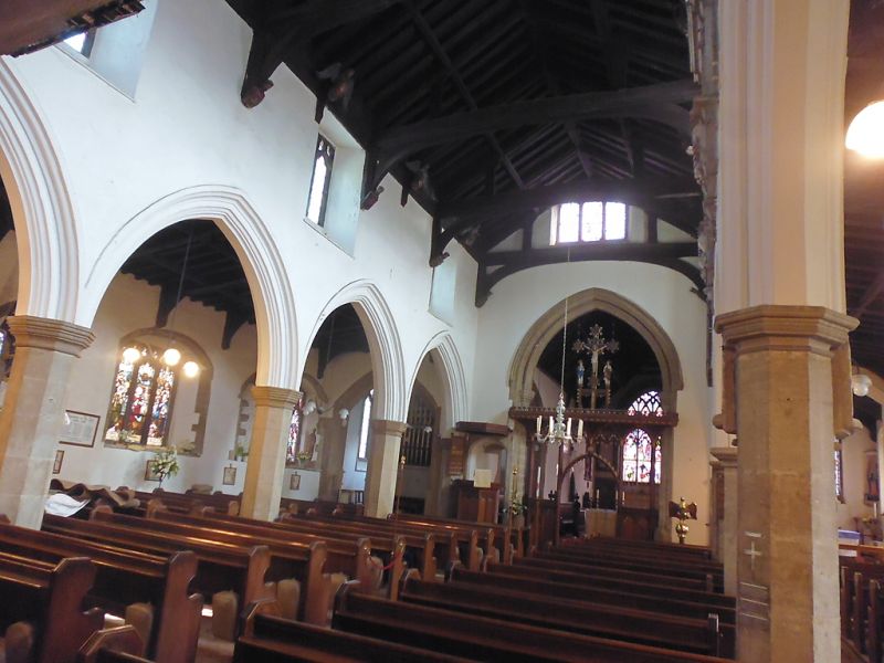
Fabric of C13 origin, refashioned in C14 and C15. Nave has C15 queenpost
roof of local type. Elaborate C15 consecration cross in south chapel. NMR
photographs.
Listing NGR: TF6127903305
External links are from the relevant listing authority and, where applicable, Wikidata. Wikidata IDs may be related buildings as well as this specific building. If you want to add or update a link, you will need to do so by editing the Wikidata entry.


Other nearby listed buildings
