Approximate Location Map
Large Map »
Latitude: 52.6041 / 52°36'14"N
Longitude: 0.3805 / 0°22'49"E
OS Eastings: 561301
OS Northings: 303358
OS Grid: TF613033
Mapcode National: GBR N5G.M0T
Mapcode Global: WHJPS.TTC1
Plus Code: 9F42J93J+J5
Entry Name: Wall at North of Churchyard of St Edmund's Church
Listing Date: 16 November 1972
Grade: II
Source: Historic England
Source ID: 1077239
English Heritage Legacy ID: 221064
ID on this website: 101077239
Location: Downham Market, King's Lynn and West Norfolk, Norfolk, PE38
County: Norfolk
District: King's Lynn and West Norfolk
Civil Parish: Downham Market
Built-Up Area: Downham Market
Traditional County: Norfolk
Lieutenancy Area (Ceremonial County): Norfolk
Church of England Parish: Downham Market
Church of England Diocese: Ely
Tagged with: Wall
1.
1051
TF 60 SW
2/1A
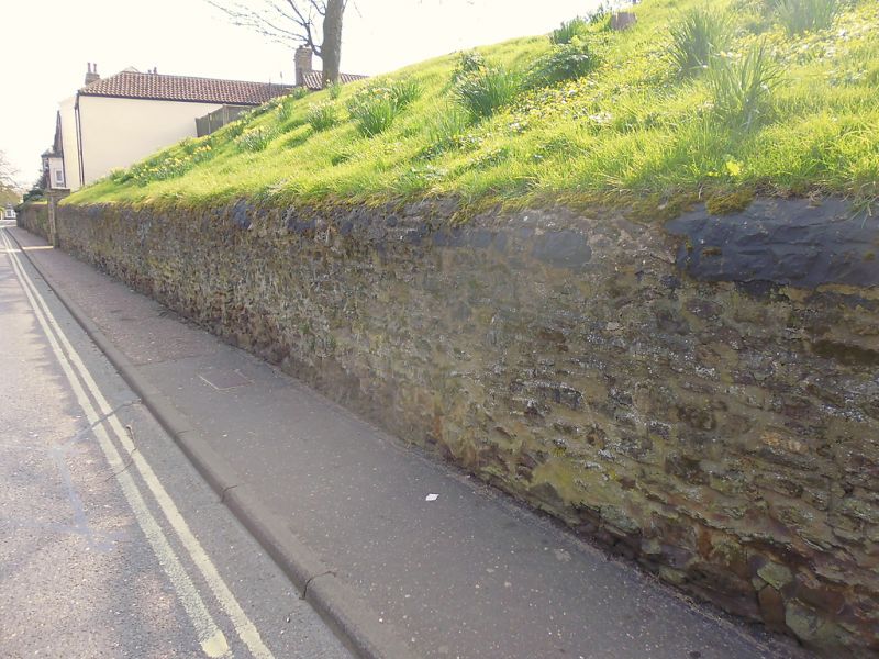
Wall at north of Churchyard of St Edmund's Church
II
2.
C18 carstone wall with rounded top. Forms retaining wall at foot of enbankment, about 4 to 5 ft high.
Listing NGR: TF6130103358
External links are from the relevant listing authority and, where applicable, Wikidata. Wikidata IDs may be related buildings as well as this specific building. If you want to add or update a link, you will need to do so by editing the Wikidata entry.


Other nearby listed buildings
