Approximate Location Map
Large Map »
Latitude: 52.9324 / 52°55'56"N
Longitude: 1.2996 / 1°17'58"E
OS Eastings: 621855
OS Northings: 342319
OS Grid: TG218423
Mapcode National: GBR VBR.5DY
Mapcode Global: WHMS2.YK19
Plus Code: 9F43W7JX+XV
Entry Name: 9, New Street
Listing Date: 21 January 1977
Grade: II
Source: Historic England
Source ID: 1373875
English Heritage Legacy ID: 222540
ID on this website: 101373875
Location: Cromer, North Norfolk, NR27
County: Norfolk
District: North Norfolk
Civil Parish: Cromer
Built-Up Area: Cromer
Traditional County: Norfolk
Lieutenancy Area (Ceremonial County): Norfolk
Church of England Parish: Cromer St Peter and St Paul
Church of England Diocese: Norwich
Tagged with: Building
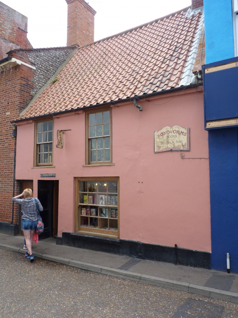
NEW STREET
1.
5320
(South Side)
No 9
TG 2142 1/45
II
2.
C18. Stuccoed. Steep pantile roof with gabled ends. 2 storeys. 2 windows. Sashes
with glazing bars, ground floor later sash without glazing bars. Recessed doorway
off centre left with panelled reveals, C19 flush-panel door. Passageway on left.
Listing NGR: TG2185342316
External links are from the relevant listing authority and, where applicable, Wikidata. Wikidata IDs may be related buildings as well as this specific building. If you want to add or update a link, you will need to do so by editing the Wikidata entry.


Other nearby listed buildings
