Approximate Location Map
Large Map »
Latitude: 52.9061 / 52°54'21"N
Longitude: 1.0901 / 1°5'24"E
OS Eastings: 607904
OS Northings: 338766
OS Grid: TG079387
Mapcode National: GBR T9C.SHM
Mapcode Global: WHLR1.Q69Y
Plus Code: 9F43W34R+C2
Entry Name: 27, Market Place
Listing Date: 8 September 1983
Grade: II
Source: Historic England
Source ID: 1169572
English Heritage Legacy ID: 223797
ID on this website: 101169572
Location: Holt, North Norfolk, NR25
County: Norfolk
District: North Norfolk
Civil Parish: Holt
Built-Up Area: Holt
Traditional County: Norfolk
Lieutenancy Area (Ceremonial County): Norfolk
Church of England Parish: Holt with High Kelling
Church of England Diocese: Norwich
Tagged with: Building
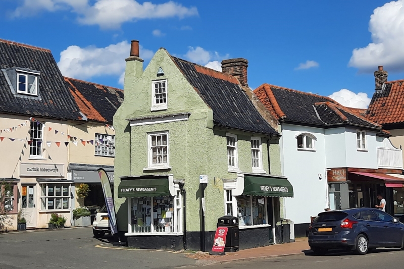
1. HOLT MARKET PLACE
5320 (north side)
No 27
TG0738NE 4/83
II GV
2.
C18. Pebbledash render, colourwashed. Steep black-glazed pantile roof. Two storeys
and attic. Parapetted gables with chimney stacks on E. & W. Sashes with glazing
bars. Projecting modern shopfronts on S. & W. elevations.
Listing NGR: TG0790438766
External links are from the relevant listing authority and, where applicable, Wikidata. Wikidata IDs may be related buildings as well as this specific building. If you want to add or update a link, you will need to do so by editing the Wikidata entry.


Other nearby listed buildings
