Approximate Location Map
Large Map »
Latitude: 52.3773 / 52°22'38"N
Longitude: 1.1092 / 1°6'33"E
OS Eastings: 611726
OS Northings: 280021
OS Grid: TM117800
Mapcode National: GBR THR.Z4S
Mapcode Global: VHL97.5HRX
Plus Code: 9F4394G5+WM
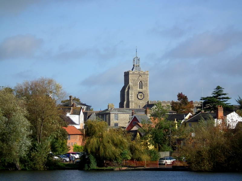
Entry Name: Church of St Mary
Listing Date: 29 December 1950
Grade: I
Source: Historic England
Source ID: 1049757
English Heritage Legacy ID: 224753
ID on this website: 101049757
Location: St Mary's Church, Diss, South Norfolk, IP22
County: Norfolk
District: South Norfolk
Civil Parish: Diss
Built-Up Area: Diss
Traditional County: Norfolk
Lieutenancy Area (Ceremonial County): Norfolk
Church of England Parish: Diss St Mary
Church of England Diocese: Norwich
Tagged with: Church building
TM 1180 DISS CHURCH STREET
(North Side)
605/4/1 Church of St Mary
29.12.1950 I
Parish Church. Mainly C14 and C15. Roofs C15. Commandments Board
late C17. NMR photograph.
Listing NGR: TM1172680021
External links are from the relevant listing authority and, where applicable, Wikidata. Wikidata IDs may be related buildings as well as this specific building. If you want to add or update a link, you will need to do so by editing the Wikidata entry.


Other nearby listed buildings
