Approximate Location Map
Large Map »
Latitude: 52.582 / 52°34'55"N
Longitude: 1.0633 / 1°3'47"E
OS Eastings: 607633
OS Northings: 302650
OS Grid: TG076026
Mapcode National: GBR TFC.5M8
Mapcode Global: WHLSL.9CKF
Plus Code: 9F43H3J7+Q8
Entry Name: Windmill
Listing Date: 2 October 1951
Grade: II
Source: Historic England
Source ID: 1050725
English Heritage Legacy ID: 226558
ID on this website: 101050725
Location: Wicklewood, South Norfolk, NR18
County: Norfolk
District: South Norfolk
Civil Parish: Wicklewood
Built-Up Area: Wicklewood
Traditional County: Norfolk
Lieutenancy Area (Ceremonial County): Norfolk
Church of England Parish: High Oak
Church of England Diocese: Norwich
Tagged with: Building
TG 00 SE WICKLEWOOD HIGH STREET
(east side)
6/85
2.10.51 Windmill.
GV II
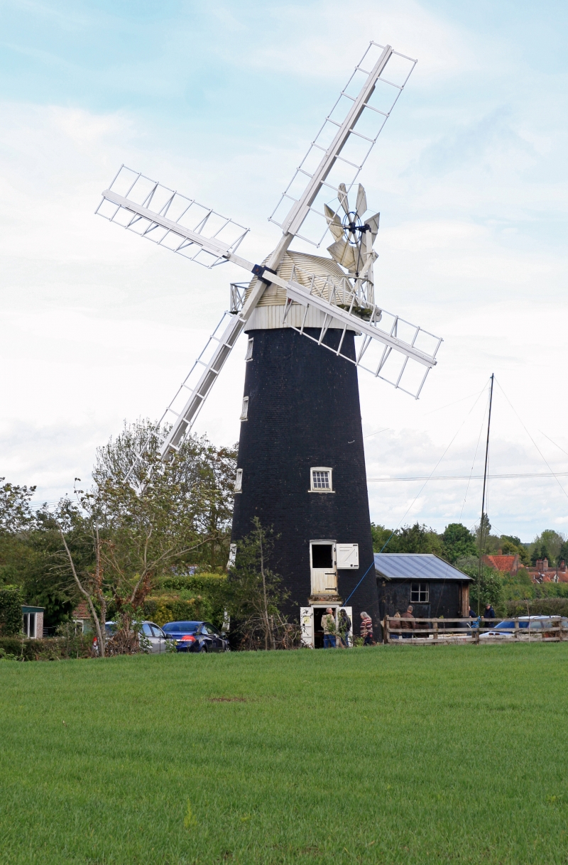
Windmill. Circa 1840. Tarred brick battered tower. 4 storeys with cap.
Small pivot windows with glazing bars of c.1980. Sails, cap, fantail, floors
and machinery of c.1980 in careful imitation of original. Included for group
value.
Listing NGR: TG0763302650
External links are from the relevant listing authority and, where applicable, Wikidata. Wikidata IDs may be related buildings as well as this specific building. If you want to add or update a link, you will need to do so by editing the Wikidata entry.


Other nearby listed buildings
